Rampart Range Easy Offroad Trail - Colorado
https://www.trailsoffroad.com/trails/430-rampart-range-road
Built in the 1930’s, this well known and fairly well-maintained runs through Pike National Forest. It crosses a number of counties from it’s North end near Sedalia all the way down through to Colorado Springs. You can start there in the Springs right from the Garden of the Gods or a small turnoff near Sedalia on 67. The southern end has the most to see in terms of viewing and is the smoother portion of the drive. There’s many turn offs, both large parking areas and small pull-offs, where you can stop to take pictures. The views of Pike’s Peak and the range are amazing.
This trail runs from ‘officially’ from South to North, and the GPX is tracked that way. It can be run both ways. Along the way, I tracked places of interest and some of the more complex intersections of road and trails.
Please note, there is no shooting directly off of this road, but some of the roads and trails nearby allow it. Watch for signage, and see the connecting trails and roads for more details. If you plan on camping, make sure to call the Forest Service or check online for fire restrictions first.
Some special notes about this trail:
You’ll notice burned trees near the southern end of the trail. The 2012 Waldo Canyon Wildfire burned 18,000+ acres and included 1500+firefighters, 70 firetrucks, and air support. The fire caused almost half a billion in damages to homes and businesses, the most to date in Colorado.
The road was built as part of the government’s efforts to get out of The Great Depression by the Civil Conservation Corps. A marker stone exists and is a waypoint along the trail. There are notes on the internet that there were once two marker stones, but it appears one may have been damaged and/or removed outright. The market stone indicates it’s opening and completion, 1933.
Get the trail details and download a GPS route today at:
http://TrailsOffroad.com
Music Licensed under Creative Commons: By Attribution 3.0 - www.bensound.com
Видео Rampart Range Easy Offroad Trail - Colorado канала Trails Offroad™
Показать
Комментарии отсутствуют
Информация о видео
Другие видео канала
 Offroading Big Bear Area - Motino Wash, 2N06X, and Holcomb Creek in 4k UHD
 Coopers Gap Road - Georgia
 Bonney Butte Road - Mount Hood National Forest, Oregon
 Grizzly Lake
 True Grit - Extreme Rock Crawling Off-Road Trail - Near Parker Arizona in 4k UHD
 Bull Canyon - Moab Utah
 Red Canyon SR2013 Easy Overland Offroad Trail - Orocopia Mountains California in 4k UHD
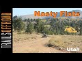 Nasty Flat Backcountry Overland Trail in Utah - Trail Guide
 Turkey Creek Trail, Cleator Arizona
 6S06 - El Cariso Truck Trail, Lake Elsinore, California
 Crystal Geyser Road - Moab, Utah
 Saran Wrap - Colorado Springs, CO
 Box Canyon Off-Road Trail near Florence - Arizona
 Teller Divide Offroad Trail near Gould, Colorado
 Roosevelt Vista 4WD Road near Globe, Arizona
 Forest Road 462 - Tijeras, New Mexico
 Short Bus Trail Review and Guide Johnson Valley California in 4K UHD
 Camaan Springs Road - Laporte, Colorado
 Coyote Lake 4wd Trail - Shaver Laker, California
 Moab Rim - Moab, UT
 3N93 Holcomb Creek Highlights - Big Bear, CA