GIS to CAD / CAD to GIS Workflow
This video demonstrates how to move data between CAD and GIS data formats.
Видео GIS to CAD / CAD to GIS Workflow канала Esri Canada Higher Education & Research
Видео GIS to CAD / CAD to GIS Workflow канала Esri Canada Higher Education & Research
Показать
Комментарии отсутствуют
Информация о видео
27 октября 2017 г. 23:45:41
00:10:36
Другие видео канала
 Working with CAD Data in ArcGIS Pro
 INSERTING GOOGLE EARTH IMAGE TO AUTOCAD | MAKE SITE PLAN IN AUTOCAD USING GOOGLE EARTH
 Converting Arc GIS Data Into Cad With Attributes
 CAD: What’s Possible with Esri and Autodesk Integration
 Exporting Shapefile from GIS to Auto CAD (Very Easy Method)
 ArcGIS for AutoCAD
 Convert GIS to CAD in ArcGIS 10 or 10.1
 Most easy way to EXTRACT CONTOURS from GOOGLE EARTH directly in AUTO CAD using GLOBAL MAPPER
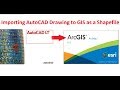 Importing AutoCAD Drawing to ArcGIS as a Shapefile (very Easy Method)
 How to extract CONTOUR LINES from anywhere in the world!
 Teaching With and Using the Experience Builder to Create Customized Web Mapping Applications
 Georeferencing CAD files in ArcMap
 ArcGIS Pro: Machine Learning Classification for Impervious Surfaces
 M7G CLOSEST FACILITY ANALYSIS IN ARCGIS PRO
 All about using maps in AutoCAD
 Introduction to ArcGIS Maps for Adobe Creative Cloud
 CAD Referencing
 ArcGIS Pro DEM and Pointfields to Rhino Mesh and Curves
 GIS Workflows in Vectorworks
 Urban Modelling with CityEngine