Glaciers|Upper Kaghan Valleya| Mansera|Pakistan|waterfall
The Kaghan Valley (Urdu: وادی کاغان) is a valley in the north-east of Mansehra District of the North-West Frontier Province of Pakistan. It attracts many tourists from around the country. The inhabitants were affected by the earthquake disaster on 8 October 2005.
The Kaghan valley is named after the town of Kaghan rather than for the Kunhar River which flows through the length of the valley. The valley extends 155 km, rising from an elevation of 2,134 feet (650 m) to its highest point, the Babusar Pass, at 13,690 feet (4,170 m). Popular languages are Hindko and Gojri, while Urdu, Pakistan's national language is also familiar among the locals. The region is Alpine in geography and climate, with forests and meadows dominating the landscape below peaks that reach over 17,000 feet.
Its mountains, dales, lakes, water-falls, streams and glaciers are still in a pristine state. Kaghan is at its best during summer (from May to September). In May the temperature ranges between a maximum of 11 °C (52 °F) and a minimum of 3 °C (37 °F). From the middle of July up to the end of September the road beyond Naran is open right up to Babusar Pass. Movement is restricted during the monsoon and winter seasons. The Kaghan area can be reached by road via the towns of Balakot, Abbottabad and Mansehra. In Balakot, one may find buses and other transports to reach Kaghan or Naran.
Видео Glaciers|Upper Kaghan Valleya| Mansera|Pakistan|waterfall автора Водные удивления
Видео Glaciers|Upper Kaghan Valleya| Mansera|Pakistan|waterfall автора Водные удивления
Информация

26 февраля 2025 г. 16:03:38
00:00:39
Похожие видео
 80 летие Великой Победы 9.05.25
 П.И. Скусниченко о концерте, посвященном Дню Победы 01.05.2025
 полет
полет ОН ДЕРЖАЛ В СТРАХЕ ЛЮДЕЙ 15 ЛЕТ | Владимир Колебин Красноярский чистильщик
 Визитка_атмосферная
 Лабытнанги-Елецкая
 Прибой океана
 Ямочный ремонт дорог , н.п.Красный Бор , СНТ "Нефтехимик", СНТ "Домостроитель" 2.
 Minecraft: Artificial Fishing Pond
 СЕМИПАЛАТИНСКИЕ ПРОФЕССИОНАЛЫ
 Днепр. Троллинг
 رحله من فيلندا الى السويد في السياره(4)
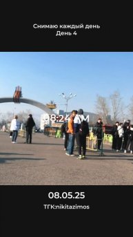 08.05.25
 МАЙСКИЙ ПЕРЕГОН HONDA N WGN,ВЛАДИВОСТОК- МОСКВА.ЧАСТЬ 1.
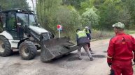 Ямочный ремонт дорог , н.п.Красный Бор , СНТ "Нефтехимик", СНТ "Домостроитель" . 1
 Кот на фоне заката — лучшее фото путешествия
 Ищем корюшку на Финском заливе. Рыбалка в Ленинградской области
 Filippos Kesapidis & Adem !!! Russia & Essentuki !!! Video by ⢢⢢⠠ Δ Ε Ν Ι Σ ⢢⢢⮮...
 A rainforest near Tucson?! Explore and learn at Biosphere 2.
 Вода уходит.бобровые платины смыло.