What are Point Clouds, And How Are They Used?
Point clouds are essentially the simplest forms of 3D models. They are collections of points plotted in 3D space on the X, Y, and Z axes. Learn more - https://www.dronegenuity.com/point-clouds/
⬇︎SHOW MORE⬇︎
About
Dronegenuity is a leading nationwide provider of aerial drone photography, video production, and mapping services. We operate across a wide range of industries including real estate & development, construction & engineering, energy, financial services, and work with thousands of skilled pilots in North America.
💡Learn More - https://www.dronegenuity.com/
_________________________________________
🚁Apply to be a Drone Pilot - https://www.dronegenuity.com/pilot-application/
📰Join our newsletter - https://conta.cc/2L7sMjz
_________________________________________
You May Also Like:
How Big Can You Print A Drone Photo?
https://youtu.be/FYTlrPJY7Es
How to Take Amazing HDR Drone Photos & Save Time Editing
https://youtu.be/4u5FdDeexj0
Point of Interest Tutorial
https://youtu.be/ou2iV0u-U2o
What does a drone see from 400, 300, 200, and 100 feet?
https://youtu.be/JIfLuTQbCJ8
How to Take Amazing Long Exposure Photos - DJI Drones
https://youtu.be/CvE7lAlPZYw
How to Take Great Drone Photos
https://youtu.be/54qv-3EPTvE
How to Connect Your Drone to DroneDeploy
https://youtu.be/YtGxdAMFFd4
Best Camera Settings - DJI Mavic Pro
https://youtu.be/D8EIkoHRi0Q
DroneDeploy Review - Aerial 3D Mapping Software
https://youtu.be/i2vJYv0aIcE
Controller Display Screen Overview - DJI Mavic Pro
https://youtu.be/W4xC2GCWTgE
5 Best Simple & Easy Cinematic Drone Shots - DJI Drones
https://youtu.be/qPuogd8Og0Q
How to Take RAW DNG Photos - DJI Drones
https://youtu.be/q_e7NFfMGqw
Controller Overview - DJI Mavic Pro
https://youtu.be/p5ZlFTz9k80
_________________________________________
Follow us:
🐦Twitter - https://twitter.com/Dronegenuity
👤Facebook - https://www.facebook.com/dronegenuity/
🌄Instagram - https://www.instagram.com/dronegenuity/
Видео What are Point Clouds, And How Are They Used? канала dronegenuity
Показать
Комментарии отсутствуют
Информация о видео
Другие видео канала
 Agisoft Metashape Tutorial - Full Processing from photos to dense cloud - with Ground Control Points
 Autoware Course Lecture 7: Object Perception: LIDAR
 Aerial Photogrammetry Explained - Create 3D Models With Drone Photos
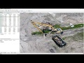
 3 reasons you should be using point clouds
 Point Cloud test in Unreal Engine
 How Does LiDAR Remote Sensing Work? Light Detection and Ranging
 Understanding 4D -- The Tesseract
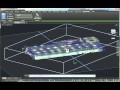 Working with Point Clouds in AutoCAD
 5 Killer Ideas for Drone Videos
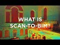 What is Scan to BIM?
 Entering the World of Point Clouds • 𝐼𝑡𝑎𝑙𝑖𝑐𝑠 Ep1
 MRI: Basic Physics & a Brief History
 5 Best Simple & Easy Cinematic Drone Shots - DJI Drones
 What Is An Orthomosaic? Orthomosaic Maps & Orthophotos Explained
 9 Tips & Tricks for Safe Indoor Drone Flying
 Point Cloud Modeling the Alpine Landscape | Christophe Girot | TEDxZurich
 PointNet: Deep Learning on Point Sets for 3D Classification and Segmentation
 How to Use DroneDeploy to Create an Orthomosaic Map
 4D Toys: a box of four-dimensional toys, and how objects bounce and roll in 4D
 Flood Risk Study Visualization w/ 3Dsurvey