Niagara River - Google Earth tour
Niagara River flows from Fort Erie (Lake Erie) to Niagara-on the-lake, (Lake Ontario). It is 52 km long, 99 m (325 ft) total vertical drop.
Видео Niagara River - Google Earth tour канала Boleslaw Dworzak
Видео Niagara River - Google Earth tour канала Boleslaw Dworzak
Показать
Комментарии отсутствуют
Информация о видео
Другие видео канала
 Hidden Niagara - Creation of the Niagara Gorge
 Niagara Falls & Area - 4K (Ultra HD) Aerial Video using DJI Phantom 4
 Niagara Falls Helicopter Flight
 Niagara Falls Tour
 Old Scow & Toronto Power Generating Station on Niagara River
 Devil's Hole Rapids on the Niagara River
 NIAGARA FALLS What side is better? USA vs Canada
 NIAGARA FALLS - HELICOPTER FULL FLIGHT 4K
 Raw 4K Footage: Niagara River Class 6 Rapids
 Niagara Falls bridge repair 1969
 7 Things To Do In Niagara Falls New York, USA
 Why the Atlantic and Pacific Oceans Don't Mix
 Top 10 Most Dangerous Waterfalls in the world
 NIAGARA FALLS - ONTARIO, CANADA 4K
 Niagara River 2020
 Top 5 BIGGEST Trees on Earth
 The Best things to do in Niagara on the Lake (E1 - Wine Country Tour by locals)
 Niagara Falls Repair
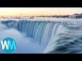 Top 10 Beautiful Waterfalls In The World
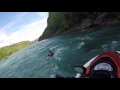 GUY FALLS OFF JETSKI IN NIAGARA FALLS RAPIDS