Vancouver-Hong Kong flight AC 7 溫哥華-香港加航航班: Alaska, Russia, Amur River река Амур 黑龙江 2016-11-09
A fully annotated Vancouver - Hong Kong flight on Air Canada with view of Georgia Strait, Comox, Campbell River, Alaska Range, Seward Peninsula, Bering Strait, Far East Russia, and the Amur River between Russia's Amur Oblast and China's Northeastern Heilungjiang province, plus a 3-minute parallel flight just above a XiamenAir jet while flying over northern China.
0:15-0:20 New (2016) Haida totem exhibits at Vancouver International Airport (YVR)
More totem pole info at:
EN: http://www.cbc.ca/news/canada/british-columbia/first-nations-artwork-vancouver-international-airport-1.3420946
CN中文: http://www.westca.com/Space/u=maohu/m=blog/p=582765/lang=tchinese.html
http://www.straight.com/arts/627656/reg-davidson-recounts-haida-myths-new-cedar-sculptures-yvr
3:52-4:43 Cockpit flight-route announcement
5:55 Bag-removal announcement (EN)
9:10 Ready-for-departure announcement
10:47-15:15 Safety demonstration video
Map of YVR ground operations on p. 247 of this document
http://www.ivao.ca/charts/CAP2/CYVR.pdf
21:25 Takeoff run begins on 8R
24:01 Start of 180-degree right westbound turn
24:11 Post-takeoff announcement EN, FR, CN-M/P CN-C
27:50 Start of 45-degree right turn to proceed northwesterly enroute
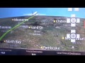
30:45 Georgia Strait
31;35 Gillies Bay BC
32:40 Comox BC
34:35 Campbell River BC
37:35 Johnstone Strait BC
38:10 Mount Menzies BC (1,193m / 3,914')
39:18 Newcastle Peak BC (1,333m / 4,373')
40:25 Knight Inlet BC
40:40 Mount Palmerston (1,765m / 5,791')
41:30 Mount Russell (1,742m / 5,715' )
44:30 Alert Bay, Cormorant Island BC
45:10 Sointula, Malcolm Island BC (BC's 100+-year-old utopian Finnish settlement)
52:20 Calvert Island BC (on BC's central coast)
53:50 Meal #1 pork & noodles
54:01 Anchorage on map
54:25 Trimokis Hills, Alaska Range ("inland side" of Alaska)
55:45-57:00 Windy Fork of Kuskokwim River, Alaska
http://alaska.guide/River/1412176/Windy-Fork-Middle-Fork-Kuskokwim-River
57:10 Lone Peak (2,646' / 806m)
57:25 Lone mountain (range)
58:00 Big River, Alaska
58:30 Kuskokwim River, Alaska
Ninth largest river in the United States (by discharge volume at its mouth)
https://en.wikipedia.org/wiki/Kuskokwim_River
59:30 McGrath, Alaska
1:01:15 Takotna Mountain (3,203' / 976m)
1:03;25 Norton Sound, Alaska
1:04:25 30 miles east of Nome, Seward Peninsula, Alaska
1:07;55 Mount Distin, Alaska 2,115' / 645m
1;12;05 Cape Douglas, Alaska
1:12:20 Port Clarence, Alaska
1:16:00 Bering Sea
For a view of Russia's development of its Pacific region:
http://carnegieendowment.org/files/CP_Larin_Eng.pdf
Берингово море
1:18:12 Crossing Bering Strait west to Russia
1:18:35 Chukotka Autonomous Okrug 721,481 км² Pop. 50,526
Far Eastern Federal District 6,169,329 км²
Чуко́тский автоно́мный о́круг Население (50 526 чел.)
Дальневосточный федеральный округ 6 169 329 км²
1:20:50 Saint Lawrence Bay, Chukotka
Залив Лаврентия, Чуко́тка
1:24:18 Lorino Pop. 1,267 in 2010
Largest indigenous village in the autonomous okrug
Лорино - проживало 1484 человека (2009)
1:25:10 Mechigmenskaya Bay / Мечигменская Губа
1:30:35 Chukotka's landscape:
"Winter storms fill valleys with deep snow that takes a long time to melt, so summer doesn't come here until July."
http://dinets.info/chukotka1e.htm
1:35:40 Map position near Kresta Bay / Залив Креста
1:37:00 Looking north above Kresta Bay / Залив Креста
1:37:43 Above Magadan Oblast / Магаданская область (after Kamchatka Krai / Камча́тский край)
1:56;00-1:57:40 Position check on map: west of Gizhigin Bay / К западу от Гижигинская губа
1:58:55 Shore at Balagannoye / Балаганное
2:00:15 Torom, Khabarovsk Krai / Тором, Хабаровский край
2:05:00 Position check: north of Khabarovsk
2:05:25 Mountains north of Khabarovsk
2:12:05 Position check: west of Khabarovsk
2:17:55-2:19:15 Amur River / река Амур / 黑龙江
2:20:55 Position check: west of Beijing
2:20:28-2:26:30 North China
2:22:45-2:25;00 Paralleling Xiamen Air jet
2:26:30 Meal #3 Pre-arrival chicken salad sandwich
2:26:40 Position check: Wuhan, central China
2:27:20 Position check: Changsha, south-central China
2:28:23 Arrival time & weather from cockpit EN & FR
2:29:25-2:30:42 Interpreted arrival weather & safety procedures Cantonese & Mandarin (Putonghua)
2:36:00 Descending into low-lying cloud layer
2:52:14 Pearl River bridge construction
2:53:47 Touchdown on 7L
Map of HKG ground operations available at:
https://extranet.hongkongairport.com/aom/Part%20L/Plan%205%20Taxiway%20and%20Taxilane%20Designations.pdf
Flight as tracked by FlightAware:
http://flightaware.com/live/flight/ACA7/history/20161109/2010Z/CYVR/VHHH
Видео Vancouver-Hong Kong flight AC 7 溫哥華-香港加航航班: Alaska, Russia, Amur River река Амур 黑龙江 2016-11-09 канала backpacktrot
0:15-0:20 New (2016) Haida totem exhibits at Vancouver International Airport (YVR)
More totem pole info at:
EN: http://www.cbc.ca/news/canada/british-columbia/first-nations-artwork-vancouver-international-airport-1.3420946
CN中文: http://www.westca.com/Space/u=maohu/m=blog/p=582765/lang=tchinese.html
http://www.straight.com/arts/627656/reg-davidson-recounts-haida-myths-new-cedar-sculptures-yvr
3:52-4:43 Cockpit flight-route announcement
5:55 Bag-removal announcement (EN)
9:10 Ready-for-departure announcement
10:47-15:15 Safety demonstration video
Map of YVR ground operations on p. 247 of this document
http://www.ivao.ca/charts/CAP2/CYVR.pdf
21:25 Takeoff run begins on 8R
24:01 Start of 180-degree right westbound turn
24:11 Post-takeoff announcement EN, FR, CN-M/P CN-C
27:50 Start of 45-degree right turn to proceed northwesterly enroute
30:45 Georgia Strait
31;35 Gillies Bay BC
32:40 Comox BC
34:35 Campbell River BC
37:35 Johnstone Strait BC
38:10 Mount Menzies BC (1,193m / 3,914')
39:18 Newcastle Peak BC (1,333m / 4,373')
40:25 Knight Inlet BC
40:40 Mount Palmerston (1,765m / 5,791')
41:30 Mount Russell (1,742m / 5,715' )
44:30 Alert Bay, Cormorant Island BC
45:10 Sointula, Malcolm Island BC (BC's 100+-year-old utopian Finnish settlement)
52:20 Calvert Island BC (on BC's central coast)
53:50 Meal #1 pork & noodles
54:01 Anchorage on map
54:25 Trimokis Hills, Alaska Range ("inland side" of Alaska)
55:45-57:00 Windy Fork of Kuskokwim River, Alaska
http://alaska.guide/River/1412176/Windy-Fork-Middle-Fork-Kuskokwim-River
57:10 Lone Peak (2,646' / 806m)
57:25 Lone mountain (range)
58:00 Big River, Alaska
58:30 Kuskokwim River, Alaska
Ninth largest river in the United States (by discharge volume at its mouth)
https://en.wikipedia.org/wiki/Kuskokwim_River
59:30 McGrath, Alaska
1:01:15 Takotna Mountain (3,203' / 976m)
1:03;25 Norton Sound, Alaska
1:04:25 30 miles east of Nome, Seward Peninsula, Alaska
1:07;55 Mount Distin, Alaska 2,115' / 645m
1;12;05 Cape Douglas, Alaska
1:12:20 Port Clarence, Alaska
1:16:00 Bering Sea
For a view of Russia's development of its Pacific region:
http://carnegieendowment.org/files/CP_Larin_Eng.pdf
Берингово море
1:18:12 Crossing Bering Strait west to Russia
1:18:35 Chukotka Autonomous Okrug 721,481 км² Pop. 50,526
Far Eastern Federal District 6,169,329 км²
Чуко́тский автоно́мный о́круг Население (50 526 чел.)
Дальневосточный федеральный округ 6 169 329 км²
1:20:50 Saint Lawrence Bay, Chukotka
Залив Лаврентия, Чуко́тка
1:24:18 Lorino Pop. 1,267 in 2010
Largest indigenous village in the autonomous okrug
Лорино - проживало 1484 человека (2009)
1:25:10 Mechigmenskaya Bay / Мечигменская Губа
1:30:35 Chukotka's landscape:
"Winter storms fill valleys with deep snow that takes a long time to melt, so summer doesn't come here until July."
http://dinets.info/chukotka1e.htm
1:35:40 Map position near Kresta Bay / Залив Креста
1:37:00 Looking north above Kresta Bay / Залив Креста
1:37:43 Above Magadan Oblast / Магаданская область (after Kamchatka Krai / Камча́тский край)
1:56;00-1:57:40 Position check on map: west of Gizhigin Bay / К западу от Гижигинская губа
1:58:55 Shore at Balagannoye / Балаганное
2:00:15 Torom, Khabarovsk Krai / Тором, Хабаровский край
2:05:00 Position check: north of Khabarovsk
2:05:25 Mountains north of Khabarovsk
2:12:05 Position check: west of Khabarovsk
2:17:55-2:19:15 Amur River / река Амур / 黑龙江
2:20:55 Position check: west of Beijing
2:20:28-2:26:30 North China
2:22:45-2:25;00 Paralleling Xiamen Air jet
2:26:30 Meal #3 Pre-arrival chicken salad sandwich
2:26:40 Position check: Wuhan, central China
2:27:20 Position check: Changsha, south-central China
2:28:23 Arrival time & weather from cockpit EN & FR
2:29:25-2:30:42 Interpreted arrival weather & safety procedures Cantonese & Mandarin (Putonghua)
2:36:00 Descending into low-lying cloud layer
2:52:14 Pearl River bridge construction
2:53:47 Touchdown on 7L
Map of HKG ground operations available at:
https://extranet.hongkongairport.com/aom/Part%20L/Plan%205%20Taxiway%20and%20Taxilane%20Designations.pdf
Flight as tracked by FlightAware:
http://flightaware.com/live/flight/ACA7/history/20161109/2010Z/CYVR/VHHH
Видео Vancouver-Hong Kong flight AC 7 溫哥華-香港加航航班: Alaska, Russia, Amur River река Амур 黑龙江 2016-11-09 канала backpacktrot
Показать
Комментарии отсутствуют
Информация о видео
Другие видео канала
 Toronto-Hong Kong flight AC15 多倫多-香港加航航班: Baffin Is; Lake Baikal/озеро Байкал, Hunan 湖南 2017-02-11
 Boeing 747 Followed by a UFO | An Out Of This World Encounter | Japan Air Lines Flight 1628
 Amazing Long Island Aerial View
 Why Planes Don't Fly Over the Pacific Ocean
 Lufthansa A380 First Class Frankfurt to Bangkok (+ First Class Terminal)
 TRIPREPORT | China Southern (ECONOMY) | Airbus A380 | Guangzhou - Beijing Capital
 El avión rebelde - Airbus A320 de Northwest Airlines (Vuelo 985) FS2020
 CROSSING THE BERING STRAIGHT | EPIC World Tour DAY 64
 World's BEST Business Class - Qatar Airways Qsuite
 The World's Most Dangerous Approach - Paro, Bhutan
 San Francisco-London flight UA901 with ATC audio: Takeoff, Sierra Nevada. River Thames 2015-08-18
 VANCOUVER | BRITISH COLUMBIA , CANADA - A TRAVEL TOUR - UHD 4K
 Airplane Sounds Compilation | Airplane cabin white noise for Sleeping | 3 Trips · 6 Hours
 World Map: Basics of World Map (विश्व का मानचित्र) | Continents & Oceans | Latitude & Longitude
 Full flight video, Seoul (Incheon) to London (Heathrow), OZ521, B777-200, Asiana Airlines
 AVIATION REVIEW of YEAR 2017 - 70 minutes PURE AVIATION (4K)
 How these Pilots Crashed their Plane While Having Fun | A Thrill at 41,000 Feet
 Belavia Tupolev Tu-154 Full Flight: Minsk to Geneva (with ATC)
 Hong Kong and Macau Compared
 San Francisco-London UA flight (with ATC audio): Lake Tahoe, Reno, Wales, River Thames 2015-08-18