NASA | Greenland's Ice Layers Mapped in 3D
http://www.nasa.gov/content/goddard/nasa-data-peers-into-greenlands-ice-sheet/
Peering into the thousands of frozen layers inside Greenland’s ice sheet is like looking back in time. Each layer provides a record of not only snowfall and melting events, but what the Earth’s climate was like at the dawn of civilization, or during the last ice age, or during an ancient period of warmth similar to the one we are experiencing today. Using radar data from NASA’s Operation IceBridge, scientists have built the first-ever comprehensive map of the layers deep inside the ice sheet.
This video is public domain and can be downloaded at: http://svs.gsfc.nasa.gov/goto?4249
Like our videos? Subscribe to NASA's Goddard Shorts HD podcast:
http://svs.gsfc.nasa.gov/vis/iTunes/f0004_index.html
Or find NASA Goddard Space Flight Center on facebook:
http://www.facebook.com/NASA.GSFC
Or find us on Twitter:
http://twitter.com/NASAGoddard
Видео NASA | Greenland's Ice Layers Mapped in 3D канала NASA Goddard
Показать
Комментарии отсутствуют
Информация о видео
Другие видео канала
 Massive Crater Discovered Under Greenland Ice
 NASA Sees Tides Under Ocean’s Surface
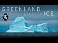 GREENLAND - LAND OF ICE 4K
 What if GREENLAND Melted?
 OSIRIS-REx Slings Orbital Web Around Asteroid to Capture Sample | 4K
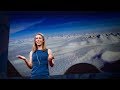 What's hidden under the Greenland ice sheet? | Kristin Poinar
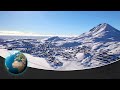 Greenland - The Largest Island in the World
 NASA’s Roman Mission Will Use Exploding Stars to Measure Cosmic Distances
 Hubble Science: Gravitational Lensing, Nature’s Boost
 Climate change: Europe's melting glaciers | DW Documentary
 Jason Box Greenland & Arctic Update
 NASA’s New DAVINCI+ Mission to Venus
 15 Largest Glacier Calving Breakoffs
 A Journey to the Arctic
 Earth 360 Video: The Call of Science
 Geologists Find Massive Impact Crater in Greenland Under a Mile of Ice
 Hubble’s Servicing Mission 4
 Could You Live Here? (Ittoqqortoormiit, Greenland)
 Scientists Reveal Their Strangest Antarctic Discoveries Yet
 Lakes Beneath Antarctic Ice: Deep Dark and Mysterious