Wilderness Navigation #6 - Plotting a Bearing onto a Map
This video covers the fourth of the four core compass skills: measuring a bearing to an object in the field, and then plotting that bearing on your map.
There are two reasons why you might want to do this.
One is to identify a landscape feature. For example, from a mountaintop, you may see a lake or other mountain in the distance, but you're not sure what it's name is.
If you take a bearing to that object, and then plot it on your map from your known location, the line will intersect that feature, and then you'll know it's name.
The second reason when you might want to do this is to help get yourself unlost.
If you're on a linear feature, such as a trail, ridge or river, plotting a single bearing to a known point, and seeing where that bearing crosses your linear feature, can give you a fairly accurate point location of where you actually are on the ground.
If you're not on a linear feature, then you need to take two or more bearings to nearby landscape features, find this features on your map, and then plot the bearings on your map. In theory, where those lines cross is your approximate location.
This technique is known as resection or triangulation.
======================================
Two important things to note here.
Anytime you're using your map and compass together, in this case measuring a bearing from the map, or as we see in video number five plotting a bearing onto a map,
We are completely ignoring the magnetic needle.
And, we are completely ignoring the orienteering arrow.
We're essentially using the compass as a protractor, and so we’re only interested in the numbers around the dial.
=======================================
A note of caution. Many navigation books talk about triangulation as a good way to get yourself un-lost, and never talk about the downsides.
This technique sounds good on paper, but it may have major limitations in the real world.
Problem 1, if you have low visibility due to nighttime or clouds or tree cover, you can't see far enough to take a bearing to any object.
Problem 2, even if you can see an object, you also need to be able to identify it on your map.
Problem 3, if you have good visibility, and you can can identify a landscape feature, it actually needs to appear on the map you're carrying.
All three of these requirements have to be in place for triangulation to work.
So, you can see that in many cases of being lost in the real world, using triangulation to locate yourself is not going to happen except under very favorable circumstances.
=======================================
Having given you that cautionary note, let's see how we actually do it.
Here's a real world example.
Say you're walking along a trail, and you want to know your precise location on that trail. You can see a nearby mountain peak that you know the name of, and it also appears on your map.
If you shoot a bearing to that peak, and plot it correctly on your map, where the plotted line crosses your trail is your approximate location. Let's do it.
It's a two-step process:
1) take a bearing to a recognizable object that appears on your map, and
2) draw that bearing onto your map.
For this example, let’s say that the bearing we take to the peak is 50°. It could be any number between 0 and 360.
Then we place one edge of our compass on the peak on our map, and then rotate the baseplate of the compass around this point until the North arrow on the compass points to the north end of the map. You can fine-tune this by using the parallel red meridian lines on the dial of your compass to line up with any grid that may be printed on your map.
I find it helpful to put the tip of a pencil or small stick directly on the mountain peak on your map around which you can more easily rotate the baseplate of your compass.
Now, we draw the bearing on our map, using the base plate as a straight edge. Where the line intersects the trail is our approximate location.
Thanks for watching. Please visit our website at www.croc.org for more videos on wilderness navigation and orienteering.
Видео Wilderness Navigation #6 - Plotting a Bearing onto a Map канала Columbia River Orienteering Club
Показать
Комментарии отсутствуют
Информация о видео
9 февраля 2016 г. 22:10:56
00:04:31
Другие видео канала
 Wilderness Navigation #4 - Following a Bearing
 Wilderness Navigation #3 - Taking a Bearing
 Wilderness Navigation #2 - Red in the Shed
 Wilderness Navigation #12 - Contours & Elevation
 Wilderness Navigation #7 - Orienting your Map
 Staying Found - wilderness trip planning tutorial
 Wilderness Navigation #1 - Parts of a Suunto M3 Compass
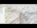 Caltopo tutorial - Free topo maps
 WIlderness Navigation #13 - Contours & Terrain
 Wilderness Navigation #9 - Adjusting Declination on your Compass
 Wilderness Navigation #11 - UTM coordinates
 Wilderness Navigation #10 - Deciphering Declination
 Wilderness Navigation #15 - Smartphone Tools for Wilderness Navigation
 Wilderness Navigation #5 - Measuring a Bearing from a Map
 Wildernesss Navigation #14 - Map Scale
 SPORTident (SI) Epunch - pre event setup
 Purple Pen Tutorial
 Wilderness Navigation #8 - Measure Distance with a Finger
 Gaia GPS Tutorial 2017
 Gaia GPS Tutorial