The Volcano and Topographic Map
Jared explains how special contour lines can turn a three dimensional volcano into a two dimensional topographic map. Very cool way to show landforms of any type: volcanoes, valleys, mountains, etc.
If you like to download your own copy of a topographic map of Mount Saint Helens, the one that Jared uses in the video, just click this link:
https://drive.google.com/file/d/1nPEc1-1hdZ6chjaIbYYNdt6Q_GIgCk8v/view?usp=sharing
Visit our channel for over 300 videos that explain science! Please subscribe.
https://www.youtube.com/c/funsciencedemos
Want to discover fun science learning tools from the best in the world?
Check out: https://www.funsciencetools.org/
Are you a teacher? We have ways to integrate science into your class!
Check out: https://www.funscience.support
Видео The Volcano and Topographic Map канала funsciencedemos
Показать
Комментарии отсутствуют
Информация о видео
Другие видео канала
 Frozen Eggs - FunScience Scavenger Hunt
 Skate Park Energy by PhET FSD Recommends
 FunScienceTools - Welcome Naomi Marla
 STEM Designing Stomp Rockets Part 2
 FSSupport Energy Page
 Clean Fresh Water So Important World Water Day March 22
 Stuck Together - FunScience Scavenger Hunt
 Egg White - Acidic or Basic?
 Hide a Penny FunScience Scavenger Hunt
 Hair Dryer and Paper Towels - FunScience Scavenger Hunt
 Box Tops - An Engineering Autopsy
 Orange Peels & Candles FunScience Scavenger Hunt
 Simple Cloud in a Bottle
 Sound - How to Make a Harmonica
 FSSupport Matter Page
 FSSupport Main Introduction
 FSSupport Sound Page
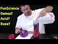 Exploring Acids Bases & Cabbage?
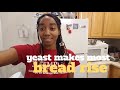 Banana Bread Rising - FunScience Scavenger Hunt
 Shiny Pennies - FunScience Scavenger Hunt