BRIENZERGRAT (Brienzer Rothorn-Harderkulm) SWITZERLAND
One of the most beautiful and CHALLENGING ridge hike in SWITZERLAND. It is classified as T4-, according to swiss hiking scale. There are some parts that are exposed but all are secured with cable or chains..partly the trail it's NOT marked..but you cannot get lost, because the trail flows on the ridge mostly.
Our second hiking the Brienzergrat ridge, full video from the hike here!! https://www.youtube.com/watch?v=0TCdPslg5jU
HERE is the other "uknown" part of the ridge starting from "Brunigpass": https://www.youtube.com/watch?v=nrm074KHU2s
The Brienzergrat trail is about 20km LONG, from Brienzer Rothorn to Harderkulm.. Brienzer Rothorn is the HIGHEST point on the route with 2350m.
The route flows up and down, there are about 12 more SUMMITS to cross on the way.. So be aware, that this takes TIME! It is NOT a walk in the countryside!
On the route there is NO water source, so be sure, that you are good covered.
If you from any reason CANNOT continue the whole trail, there are many ways to go down earlier, the descents are regularly placed over whole trail.
If you have enough of time, I would highly recommend, to save some money on the Train to Br.Rothorn and hike up from Brienz, then stay the night in the "Berghaus Rothorn" watch the Sunset.
Camping /biwak anywhere on the ridge in this mountain area is strictly FORBIDDEN, because of the wild nature protection.
If you want a challenge, you can start hike the COMPLETE RIDGE from "Brunnigpass" via Rothorn to Interlaken. =) Really good stamina and fitness needed!
Brienzergrat riedergrat hardergrat brienzer rothorn lake brienz brienz interlaken
June 2017
Thanks for watching.
patrik&teri
Видео BRIENZERGRAT (Brienzer Rothorn-Harderkulm) SWITZERLAND канала patrik&teri
Показать
Комментарии отсутствуют
Информация о видео
Другие видео канала
 This Ridge-Hike Was Too Intense For Me | Hiking The Hardergrat/Brienzergrat Trail, Switzerland in 4K
 Brienzer Gratwanderung | 20Km auf Messers Schneide | Wandern im Berner Oberland
 Harder Kulm Interlaken Switzerland – Sometimes we don’t need to travel far – Panorama over 2 Lakes
 Hardergrat Trail in Switzerland- Epic Drone Footage
 Why do I hike | Award Winning Documentary 2020 (English)
 Tannhorn Schlüsselstelle
 Train to Brienz Rothorn Switzerland 2020
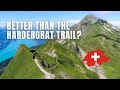 Stunning ridge trail at Brienzer Rothorn • Best Hikes in Switzerland
 Hardergrat. Augstmatthorn. Schweiz.
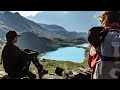 Switzerland's Most Beautiful Hike / Schynige Platte - Bachalpsee - First
 Schlüsselstelle vom First zum Latrejespitz
 BRIENZERGRAT / Hiking the Most Beautiful Ridge in Switzerland / Bernese Alps
 Schwarzmönch 2649m via Silberhornhütte/Most Beautiful Alpine Hike in the Jungfrau Region/Stechelberg
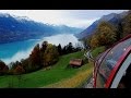 Scenic Switzerland from The Brienz Rothorn Bahn (Cog Railway)
 Complete Brienzergrat on a single day (34.5km, 3450m elev. gain)
 Thrill Walk in Switzerland | A trip from Lauterbrunnen to Schilthorn
 Brienzergrat, Swissmountains, 4K
 Fründenschnur / Hiking Narrow path high above Oeschinen Lake / We met huge Ibex Colony / Kandersteg
 Brienz Rothorn Bahn, Switzerland
 MTB Switzerland - Gornergrat classic to Zermatt in 4K // August 2019