Trans Euro Trail - TET - Enduro in Croatia
Country: CROATIA, Balkans
Lenght: 371 km
Time to cover: 2 days
Best time to ride: Spring, Summer, Autumn
Language: Croatian, most people speak English
Currency: Kuna
Track, gpx source: https://www.transeurotrail.org/croatia
Trans Euro Trail community: http://transeurotrail.org/forum/index.php
Country location: https://goo.gl/maps/mNThQh95W1woejCi8
Challenging section: PART's hill 02:40
N44.269624° E15.610640° - https://goo.gl/maps/ALqdNxeJ6ukbLjYh7
Coming from north is doable (downhill). Coming from south (uphill) is a challenge.
For any question, guidance and gpx files feel free to contact me via 4motoraid@gmail.com
Video equipment:
hero 3 on the back
hero3+ on the helmet
drone: mavic air
tripod: HDC-TM700
post production: Filmora
Видео Trans Euro Trail - TET - Enduro in Croatia канала moToRAID
Показать
Комментарии отсутствуют
Информация о видео
Другие видео канала
 Trans Euro Trail - TET - Enduro in Montenegro
 Als ANFÄNGER alleine OFFROAD über den TET?! Ein Reisebericht
 TET Norway, day 4
 Tackling Bastard Lane in Wales, Start To Finish, Trans Euro Trail
 TET Croatia and Bosnia 2021
 Gapwood Pictures - 2020 TET motorcycle trip to Croatia, Montenegro and Serbia
 Trans Euro Trail Belgien/Frankreich - Meine Erfahrung / Enduristan Blizzard Test nach 2500km
 Full TET Sweden - 3200km / 7 days solo trip on Tenere 700 (June 2021)
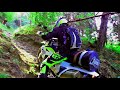 Trans Euro Trail (TET) Italien Slowenien
 TET 2019 Slovenia-Croatia-BiH
 Trans Euro Trail - Spain 2
 How lightweight is too lightweight for the Trans Euro Trail?
 TET Estonia too Hard for Me and my Tenere 700?
 Trans Euro Trail ||| SLOVENIA ||| TET Balkan
 Trans Euro Trail (TET) Spain, section Andalucía, scouting new tracks
 Trans Euro Trail - TET - Enduro in Greece
 Solo Riding Across Europe and the Trans Euro Trail
 TET Greece 2020 - Grecja na KTM Adventure Full Movie
 TET Portugal 2019 on big bikes
 TET Italien Trans Euro Trail - T7 Tenere 700 Teil I - Motorrad Abenteuer und Erfahrungen - Crash