Google Earth ve Surfer 13 Programları ile 3 Boyutlu Modelleme Yapılması
Kml verisine yükselti değerlerini eklemek için: https://www.gpsvisualizer.com/elevation
TCX Converter İndirme Linki: http://tcx-converter.freedownloadscenter.com/windows/free/
TCX CONVERTER'DA YÜKSEKLİK (YÜKSELTİ) DEĞERLERİNİN GELMEMESİ PROBLEMİNİN ÇÖZÜMÜ
1-) https://www.gpsvisualizer.com/elevation sitesine gidin.
2-) Sitede "Solution #1: Dem Database" başlığının altında bulunan pencerede yer alan "Upload a file" bölümünde indirmiş olduğunuz ".kml" uzantılı dosyanızı seçin.
3-) Daha sonra "Convert & add elevation" 'a tıklayarak dönüşüm işlemini gerçekleştirin. (Output: GPX file seçili olacak)
4-) Dönüşüm işlemi gerçekleştirildiğinde, yükseklik değerleri de elde edilmiş ".gpx" uzantılı dosya elde edilmiş olur. Yeşil fontla yazılı ".gpx" ile biten linke tıklayarak dosyayı bilgisayarınıza indirin.
5-) Daha sonra TCX Converter programına gidin. "Open Bestand" a tıklayarak, indirdiğiniz ".gpx" uzantılı dosyayı çağırın. Dönüştürme işlemi otomatik olarak gerçekleşecek ve "ALT" sütununda yükseklik değerleri gözlemlenecektir.
6-) Sıkıntı oluşan kısım burasıydı. Buradan sonra videoyu aynen takip ederek geri kalan işlemleri gerçekleştirin. Kolay gelsin...
************************************************************************************************
To add elevation values to Kml data: https://www.gpsvisualizer.com/elevation
TCX Converter Download Link: http://tcx-converter.freedownloadscenter.com/windows/free/
SOLUTION OF THE PROBLEM OF TROUBLESHOOTING VALUES IN TCX CONVERTER
1-) Go to https://www.gpsvisualizer.com/elevation site.
2-) Select your ".kml" file that you downloaded in the "Upload a file" section in the window under "Solution # 1: Dem Database" on the site.
3-) Then click "Convert & add elevation" to perform the conversion process. (Output: GPX file will be selected)
4-) When the conversion process is performed, the file with the extension ".gpx" is obtained, where the height values are also obtained. Download the file to your computer by clicking the link ending with ".gpx" written in green font.
5-) Then go to TCX Converter program. Click "Open Bestand" to call the file with the ".gpx" extension you downloaded. The conversion process will take place automatically and height values will be observed in the "ALT" column.
6-) This is where the problem occurred. After that, follow the video and do the rest. Good luck...
Видео Google Earth ve Surfer 13 Programları ile 3 Boyutlu Modelleme Yapılması канала Mustafa Ceylan
Показать
Комментарии отсутствуют
Информация о видео
Другие видео канала
 Google Earth : Comment générer des Courbes de Niveau?!
 Google Earth ve Surfer 13 ile 3 Boyutlu Arazi Modelleme
 UYDU ÜZERİNDEN DEFİNE HAZİNE KÜP ODA BOŞLUK TREASURE КАЗНАЧЕЙСКИЙ ,FINDING TREASURY WITH A SATELLITE
 Drawing Contour Map from Google Earth using Surfer 13, Quikgrid
 Introduction to Voxler 4
 tümülüs keşfetik/ içerdeki neyin nesi /mezar /lahit/oda/define peşindeyiz / dedektör /alan tarama
 Surfer 20 3D Surface Maps
 define odalarında merdiven olurmu /astra görüntü /deve işaretleri/tavuk işaretleri/yer altı görüntü
 Google Earth Pro ve Surfer 13 Programları İle Topoğrafya Haritası Oluşturma ve Kesit Alma
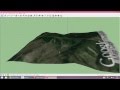 Google Sketch up Google Earth kullanarak topografya haritası olusturmak
 Introduction to ArcGIS Model Builder
 Exporting KML KMZ files from Surfer for use in Google Earth
 Çalışma Alanına Ait Jeoloji Verilerinin MTA'nın Sitesinden İndirilmesi
 OpenTopography Sitesinden Sayısal Yükseklik Modeli (DEM) Verisinin İndirilmesi
 Google Earth ile Yüksek Kalitede Sayısal Yükselti Modeli Oluşturma
 astra ile define bulma define keşfi yaptık /birbirinden ilginç/3 boyutlu inceleme/define kasaları
 voxler surfer earth define analiz/ tümülüs açtik içinde dolu oda /define isaretleri /karla mezari
 surfer/voxler/astra izme/google earth / hakında bilinmesi gerekenler/ izle dinle/karar ver.
 Surfer v16-18 Map Types Training Video
 Visualizing Surfer 13 data in Google Earth