Hawaii Kilauea Volcano September 2023 Eruption Update
According to the USGS, Kīlauea volcano is erupting. At approximately 3:15 p.m. HST on September 10, 2023, the USGS Hawaiian Volcano Observatory observed eruptive activity in Kīlauea summit webcam images and from field reports indicating that an eruption has commenced within Halemaʻumaʻu crater and on the down dropped block to the east in Kīlauea’s summit caldera, within Hawai‘i Volcanoes National Park.
Kilauea Volcano Quick Facts
Location: Island of Hawai‘i
Latitude: 19.421° N
Longitude: 155.287° W
Elevation: 1,222 (m) 4,009 (f)
Volcano type: Shield
Composition: Basalt
Most recent eruption: June 19, 2023
Nearby towns: Volcano, Pāhoa, Kalapana, Mountain View
HAWAIIAN VOLCANO OBSERVATORY DAILY UPDATE
U.S. Geological Survey
Tuesday, September 12, 2023, 9:31 AM HST (Tuesday, September 12, 2023, 19:31 UTC)
KILAUEA (VNUM #332010)
19°25'16" N 155°17'13" W, Summit Elevation 4091 ft (1247 m)
Current Volcano Alert Level: WATCH
Current Aviation Color Code: ORANGE
Activity Summary: The Kīlauea summit eruption that began on September 10th continues this morning. Eruptive activity is confined to the downdropped block and Halemaʻumaʻu crater within Kīlauea's summit caldera. No unusual activity has been noted along Kīlauea’s East Rift Zone or Southwest Rift Zone.
Halemaʻumaʻu Lava Lake Observations: Several lava fountains remain active on the western side of the downdropped block within Kīlauea's summit caldera. The easternmost vents on the downdropped block and the westernmost vents in Halema‘uma‘u became inactive yesterday, and the remaining active vents on the downdropped block span approximately 0.5 miles (750 m). These vents are roughly east-west trending and are feeding channelized lava flows traveling in north and west directions onto Halema‘uma‘u crater floor. The eastern rim of Halema‘uma‘u crater has been buried by new lava flows, and pāhoehoe lava flows cover most of the crater floor except high ground formed during previous eruptive activity in the southwest portions of the crater. Effusion rates appear down from initial eruptive rates, but remain high. Lava fountain heights have decreased since the eruption onset, but remain up to about 10-15 meters (32-50 feet) high this morning. The laser rangefinder is aimed at a western portion of Halema‘uma‘u crater, not near the new eruptive activity, and recorded nearly 5 m (16 feet) of uplift to this locality since the eruption started. This demonstrates that a significant amount of lava has intruded beneath the pre-existing crust within Halema'uma'u.
A live-stream video of the eruption is available at https://www.youtube.com/usgs/live.
An eruption reference map is available at https://www.usgs.gov/maps/september-11-2023-kilauea-summit-eruption-reference-map.
Eruption thermal maps are available at https://www.usgs.gov/maps/september-11-2023-kilauea-summit-thermal-map.
More eruption information is available at: https://www.usgs.gov/volcanoes/kilauea/recent-eruption.
S2cam was deployed yesterday and provides views of the eruption from the caldera floor: https://www.usgs.gov/observatories/hvo/s2cam-kilauea-caldera-downdropped-block-and-halemaumau-crater-looking-west.
Summit Observations: Summit tilt has remained deflationary over the past 24 hours. Summit seismic activity is dominated by eruptive tremor (a signal associated with fluid movement) with very few volcano tectonic earthquakes. Volcanic gas emissions in the eruption area are elevated; a sulfur dioxide (SO2) emission rate of 49,000 tonnes per day was measured yesterday afternoon, September 11. This is down significantly from the 190,000 tonnes per day measured just after the onset of the eruption on Sunday, September 10th.
Rift Zone Observations: No unusual activity has been noted along the East Rift Zone or Southwest Rift Zone; steady rates of ground deformation and seismicity continue along both. Measurements from continuous gas monitoring stations downwind of Puʻuʻōʻō in the middle East Rift Zone—the site of 1983–2018 eruptive activity—remain below detection limits for SO2, indicating that SO2 emissions from Puʻuʻōʻō are negligible.
Видео Hawaii Kilauea Volcano September 2023 Eruption Update канала Volkan Yuksel
Показать
Комментарии отсутствуют
Информация о видео
Другие видео канала
 Flight from Mont Blanc, France to Turin, Italy area - 4K
 Orchids Greenhouse Tour from South Florida
 Rewrite The Stars at Celebrity BEYOND
 Young Grackle Bird Rescue
 Landing and Walking on Glacier - Mendenhall Glacier, Alaska
 Drive Thru Scenic Needles Highway to Sylvan Lake and the Needles Eye Tunnel at Custer State Park, SD
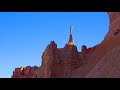 Stunning Bryce Canyon National Park of Utah
 Seven Magic Mountains near Las Vegas, NV
 Santa Fe, New Mexico skies Time Lapse
 Walking Around Westlake, Florida and a Model Home Tour
 Atlantis Paradise Island, Bahamas before Hurricane
 Zion National Park North Scenic ride with the shuttle bus
 Hawaii Kilauea Volcano Halemaumau Crater Lake Eruption Flight Video Update 🌋- 10/1/2021
 The Essential Driving Around West Palm Beach and Palm Beach, Florida Update
 Anhinga Bird - 4K
 Hawaii Mauna Loa Volcano Eruption Update 12/03/2022
 LG V20 test video at Antarctica - 4K
 Prince's Purple Rain Live Cover at Celebrity BEYOND
 Hawaii Mauna Loa Volcano Eruption Update 12/02/2022
 Mountain on the Moon