How to Download Free Geo-Reference High Resolution Satellite imageries (2 meter) from SAS Planet
In this tutorial I will show you how to download Free High Resolution Settelite imagries.
the following Settelite imagries will be download from this Tutorial.
-Free Geo-Reference Bing imagries (2m)
-Free Geo-Reference Google Earth Imagries (1.5m)
-Free Geo-Reference ESRI Imagries (2)
Sas Planet Nightly
Link:https://drive.google.com/uc?export=download&id=1xE1TSvh7pBbd3h2gyT23CrVhMV7MTAYa
Видео How to Download Free Geo-Reference High Resolution Satellite imageries (2 meter) from SAS Planet канала Advance Geospatial Technology
Показать
Комментарии отсутствуют
Информация о видео
26 января 2021 г. 13:01:54
00:04:25
Другие видео канала
 Download high resolution (50cm) satellite images from soar | download and upload drone images
 How to Download Satellite Image Landsat 8 OLI, 7 ETM+, 4-5 TM, 1-5 MSS
 حمل صور جوية حديثة Sas planet how to download high resolution satellite image 2017
 converting shapefile to kml and importing it to sasplanet
 Free High Resolution Satellite Image 0.3m / 0.5m Download
 How To Download High Resolution Topographic Maps Using Google Earth Pro
 Three Ways To Import OpenStreetMap Data In SketchUp
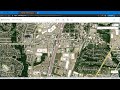 How to get the most current satellite imagery
 how to download Google Earth images very high resolution using Sasplanet
 SAS PLANET: Download very High Resolution Google earth Image for free
 A new high resolution satellite images 2019 by Sas planet
 Google Earth Engine: Landsat Time Series with Google Earth Engine
 SASPlanet: How To Update Google Map (Satellite) Image Manually | Fix Error In SASPlanet Imagery
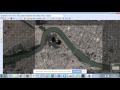 SAS PLANET how to download satellite images free
 Download High Resolution Google Earth Image from SAS Planet II SAS Planet Tutorial
 7. Download Satellite Images inside QGIS
 Tutorial 2 How to export satellite image using Global Mapper
 DEM Accuracy Assessment | SRTM ASTER DEM DTM | RMSE | ArcGIS/ArcMap
 From Google Maps to 3D Map in Blender- 3D Blender GIS -
 How to download Satellite images Using SAS Planet By (AmBer)