Beyond Where: Modeling Spatial Relationships and Making Predictions
Once we’ve identified where patterns are present, the next logical question is “why?” This workshop will cover techniques for examining, modeling and exploring our spatial data to uncover relationships and predict spatial outcomes. Application and use of generalized linear regression (GLR) and geographically weighted regression (GWR) will be demonstrated, including a look at new functionality to model both count and binary data using poisson and logistic models. You will learn how to build a model and how to effectively interpret the results and diagnostics
--------------------------------------------------------------------------------------------------------------------------
Follow us on Social Media!
Twitter: https://twitter.com/Esri
Facebook: https://facebook.com/EsriGIS
LinkedIn: https://www.linkedin.com/company/esri
Instagram: https://www.instagram.com/esrigram
The Science of Where: http://www.esri.com
Видео Beyond Where: Modeling Spatial Relationships and Making Predictions канала Esri Events
Показать
Комментарии отсутствуют
Информация о видео
Другие видео канала
 Esri 2014 UC Tech Session: Modeling Spatial Relationships Using Regression Analysis
 Using Spatial Statistics to do More: Simple Approaches
 Random Forest Classification using the Semi-Automatic Classification Plugin for QGIS
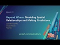 Beyond Where: Modeling Spatial Relationships and Making Predictions
 Introduction to Forecasting in Machine Learning and Deep Learning
 Understanding Predictive Modeling with R
 Spatial Data Mining I: Essentials of Cluster Analysis
 Multinomial classification with tidymodels and volcano eruptions
 Advanced Feature Engineering Tips and Tricks - T. Scott Clendaniel
 Geographically Weighted Regression for Excel
 Petroleum from Red Sea to Somalia
 Virtual Reality (VR) and Augmented Reality (AR) with ArcGIS
 Tableau Zen Master Tips & Tricks - Charts Edition
 ArcGIS Pro Model Builder | ArcGIS Mastery Course
 Introducing Coordinate Systems and Map Projections
 spatial modeling of tsunami inundation using arcgis - Mapvel geospatial
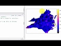 Spatial Regession in R 1: The Four Simplest Models
 Geospatial Deep Learning with ArcGIS
 Spatial Data Mining II: A Deep Dive into Space-Time Analysis