- Популярные видео
- Авто
- Видео-блоги
- ДТП, аварии
- Для маленьких
- Еда, напитки
- Животные
- Закон и право
- Знаменитости
- Игры
- Искусство
- Комедии
- Красота, мода
- Кулинария, рецепты
- Люди
- Мото
- Музыка
- Мультфильмы
- Наука, технологии
- Новости
- Образование
- Политика
- Праздники
- Приколы
- Природа
- Происшествия
- Путешествия
- Развлечения
- Ржач
- Семья
- Сериалы
- Спорт
- Стиль жизни
- ТВ передачи
- Танцы
- Технологии
- Товары
- Ужасы
- Фильмы
- Шоу-бизнес
- Юмор
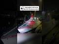
China's New GEO-SAR Satellites: Tracking U.S. Carriers from 35,800km High
In a significant breakthrough for maritime surveillance and space technology, Chinese researchers have demonstrated the ability to track large naval vessels from Geosynchronous Orbit (GEO). Using a network of just three Geosynchronous Synthetic Aperture Radar (SAR) satellites, this new architecture overcomes previous limitations of signal degradation and atmospheric interference.
The recent successful tracking of the 340-meter Japanese tanker, 'Towa Maru,' from an altitude of 35,800 kilometers proves that continuous, 24/7 monitoring of the Atlantic, Indian, and Pacific oceans is now a reality. This technical leap utilizes advanced processing architectures to maintain high-resolution imaging despite extreme distances and weather conditions.
This video analyzes the technical specifications of SAR technology and its impact on global maritime transparency, specifically regarding the detection of large strike groups and the operational environment of ballistic systems like the DF-21D and DF-26.
#SpaceTech #MaritimeSurveillance #SatelliteTechnology #ScienceAndTech
Видео China's New GEO-SAR Satellites: Tracking U.S. Carriers from 35,800km High канала World Defense Bulletin
Комментарии отсутствуют
Информация о видео
15 апреля 2026 г. 14:32:53
00:01:13
Другие видео канала