Driving from Venice Beach to Downtown Los Angeles via Venice Boulevard- 4K
Driving from Venice Beach to Downtown Los Angeles via Venice Boulevard- 4K
Evening drive on Venice Boulevard from west to east, from the oceanbto Downtown LA
Dash Cam Tours
#Tour #LosAngeles #Venice
Venice Boulevard is a major east–west thoroughfare in Los Angeles, running from the ocean in the Venice district, past the I-10 intersection, into downtown Los Angeles.
It was originally known as West 16th Street under the Los Angeles numbered street system
The western terminus of Venice Boulevard is Ocean Front Walk in Venice.
Proceeding easterly, it assumes the designation California State Route 187 crossing Lincoln Boulevard (State Route 1).
The route then passes through the Mar Vista neighborhood.
Further east, it briefly forms the boundary between Palms and Culver City and passes near Sony Pictures Studios.
Continuing northeast into the Crestview neighborhood in West Los Angeles, the SR 187 designation terminates at the intersection with Cadillac Avenue and the ramp carrying traffic from westbound I-10.
Continuing to parallel Washington Boulevard directly to its south, as it does for much of its length, the route proceeds between the Pico-Robertson neighborhood in West Los Angeles and Lafayette Square in Mid-City, through the Mid-Wilshire district, through Arlington Heights and Harvard Heights, dips under the Harbor Freeway, and continues into the heart of downtown Los Angeles, where it turns into East 16th Street at Main Street.
Follow on Twitter:
(@SafetyPint): https://twitter.com/SafetyPint?s=09
Dashcamtours.com
Subscribe to my SECOND CHANNEL with walking tours:
https://www.youtube.com/channel/UCviDr0pi64qY3SWIDvlJErw/videos
Видео Driving from Venice Beach to Downtown Los Angeles via Venice Boulevard- 4K канала Dash Cam Tours
Показать
Комментарии отсутствуют
Информация о видео
Другие видео канала
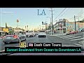 Driving on Sunset Blvd from Ocean to Downtown Los Angeles October 30, 2020 4K Dash Cam Tours
![[4K] Scenic Drive: Malibu - Santa Monica - Venice Beach via Pacific Coast Highway Calfiornia 1](https://i.ytimg.com/vi/afl7Zm-6JRY/default.jpg) [4K] Scenic Drive: Malibu - Santa Monica - Venice Beach via Pacific Coast Highway Calfiornia 1
[4K] Scenic Drive: Malibu - Santa Monica - Venice Beach via Pacific Coast Highway Calfiornia 1 Broadway Driving in Northside Chicago 4K :Streets of the Americas:
 Abbot Kinney Boulevard Venice Walking Tour | Los Angeles 4k Ultra HD | 🔊 Binaural Sound
![Driving California Pacific Coast [4K] Prescadero-San Francisco-Bolinas](https://i.ytimg.com/vi/4-DabzWSAdQ/default.jpg) Driving California Pacific Coast [4K] Prescadero-San Francisco-Bolinas
Driving California Pacific Coast [4K] Prescadero-San Francisco-Bolinas![Driving Tour of Pacific Palisades, California, USA 2020 [4K] Dash Cam Tours](https://i.ytimg.com/vi/SPaEa5ZfEhM/default.jpg) Driving Tour of Pacific Palisades, California, USA 2020 [4K] Dash Cam Tours
Driving Tour of Pacific Palisades, California, USA 2020 [4K] Dash Cam Tours Weekend Drive from Los Angeles to Mammoth Mountains Ski Resort -4K
 Rosecrans Avenue from Manhattan Beach to Fullerton, California - 4K Best & Worst of LA in one Drive
![[4K] Walking from Venice Beach to Santa Monica Pier in Los Angeles, California USA](https://i.ytimg.com/vi/Fhg8tvyJbAo/default.jpg) [4K] Walking from Venice Beach to Santa Monica Pier in Los Angeles, California USA
[4K] Walking from Venice Beach to Santa Monica Pier in Los Angeles, California USA Scenic Drive - Long Beach to Dana Point via Pacific Coast Highway - 4K
![May 15, 2020 [4K] Driving on Washington Boulevard in Los Angeles. Dash Cam Tours 🚘](https://i.ytimg.com/vi/mVQYYv0MogE/default.jpg) May 15, 2020 [4K] Driving on Washington Boulevard in Los Angeles. Dash Cam Tours 🚘
May 15, 2020 [4K] Driving on Washington Boulevard in Los Angeles. Dash Cam Tours 🚘 Dash Cam Tours 🚘 Driving through Los Angeles from East to West. No music. No talking
![[4K] Driving at Sunset Blvd - Beverly Hills to East Hollywood in Los Angeles California USA](https://i.ytimg.com/vi/iBSfljfnE30/default.jpg) [4K] Driving at Sunset Blvd - Beverly Hills to East Hollywood in Los Angeles California USA
[4K] Driving at Sunset Blvd - Beverly Hills to East Hollywood in Los Angeles California USA![[4K] 🎄 Downtown Santa Monica, Los Angeles, California - 3rd Street Promenade Christmas Walking Tour](https://i.ytimg.com/vi/Ev1Qc5_2byM/default.jpg) [4K] 🎄 Downtown Santa Monica, Los Angeles, California - 3rd Street Promenade Christmas Walking Tour
[4K] 🎄 Downtown Santa Monica, Los Angeles, California - 3rd Street Promenade Christmas Walking Tour![[4K] Driving entire Wilshire Blvd from Santa Monica to Downtown Los Angeles in California](https://i.ytimg.com/vi/mXmR1XAnyBk/default.jpg) [4K] Driving entire Wilshire Blvd from Santa Monica to Downtown Los Angeles in California
[4K] Driving entire Wilshire Blvd from Santa Monica to Downtown Los Angeles in California Driving from Sunland-Tujunga to Glendale via Glenoaks Blvd - 4K Los Angeles Neighborhoods Tour
![[4K] Driving Downtown Los Angeles DTLA - East Cesar E Chavez, 1st Street, Grand Ave, California, 4K](https://i.ytimg.com/vi/FGtswSpxhck/default.jpg) [4K] Driving Downtown Los Angeles DTLA - East Cesar E Chavez, 1st Street, Grand Ave, California, 4K
[4K] Driving Downtown Los Angeles DTLA - East Cesar E Chavez, 1st Street, Grand Ave, California, 4K 100-mile Drive in Los Angeles Rain 🌧 4K
![[4K] Driving around Downtown Los Angeles during Lockdown / Quarantine in California USA](https://i.ytimg.com/vi/WFkw2YFEvE0/default.jpg) [4K] Driving around Downtown Los Angeles during Lockdown / Quarantine in California USA
[4K] Driving around Downtown Los Angeles during Lockdown / Quarantine in California USA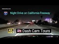 Night Driving from San Ysidro (San Diego Co) to Los Angeles on California Freeway 4K Dash Cam Tours