Hands-on Satellite Imagery Analysis | Scipy 2019 Tutorial | Samapriya Roy, Sara Safavi
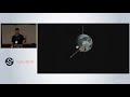
Satellite data is more widely available than ever before, and it is now possible for the public to access sub-weekly and even daily imagery of the Earth's entire landmass. In this tutorial, gain hands-on experience exploring Planet’s publicly-available satellite imagery and using Python tools for geospatial and time-series analysis of medium- and high-resolution imagery data. Using free & open source libraries, learn how to perform foundational imagery analysis techniques and apply these techniques to real satellite data. At the end of the workshop, we’ll demonstrate how the skills you've learned can be applied to investigate real-world environmental and humanitarian challenges.
See tutorial materials here: https://www.scipy2019.scipy.org/tutorial-participant-instructions
See the full SciPy 2019 playlist at https://www.youtube.com/playlist?list=PLYx7XA2nY5GcDQblpQ_M1V3PQPoLWiDAC
Connect with us!
*****************
https://twitter.com/enthought
https://www.facebook.com/Enthought/
https://www.linkedin.com/company/enthought
Видео Hands-on Satellite Imagery Analysis | Scipy 2019 Tutorial | Samapriya Roy, Sara Safavi канала Enthought
Показать
Комментарии отсутствуют
Информация о видео
Другие видео канала
 Using SatPy to Process Earth observing Satellite Data | SciPy 2019 Tutorial | David Hoese
 Using Convolutional Neural Networks to Automatically Analyze Aerial and Satellite Imagery
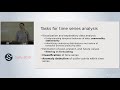 Modern Time Series Analysis | SciPy 2019 Tutorial | Aileen Nielsen
 How to Pull Images from Satellites in Orbit (NOAA 15,18,19 and METEOR M2)
 The Jupyter Interactive Widget Ecosystem | Scipy 2019 Tutorial | Breddels, Craig, Grout, Renou
 NASA ARSET: Groundwater Monitoring using Observations from NASA’s GRACE Missions
 Earth Engine Python API for Remote Sensing Data Analysis
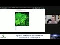 Spatial Analysis & Visualizationusing Datashader & Xarray-Spatial - Brendan Collins
 LEARN OPENCV in 3 HOURS with Python | Including 3x Example Projects (2020)
 When deep learning meets satellite imagery
 How Computers See the Earth: A ML Approach to Understanding Satellite Imagery (Cloud Next '18)
 How China Tracks Everyone
 Dashboarding with Jupyter Notebooks, Voila and Widgets | SciPy 2019 | M. Breddels and M. Renou
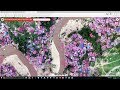 Measuring Impact with Remotely Sensed Imagery and Machine Learning
 Katherine Scott Python from Space Analyzing Open Satellite Imagery Using the Python Ecosystem
 RAPIDS: Open GPU Data Science | Scipy 2019 Tutorial | Scopatz, Becker, Kraus, Gama Dessavre
 Meha Jain - A Scalable Satellite-based Crop Yield Mapper
 ArcGIS Python API in Jupyter Notebooks | burdGIS
 Download and Convert CHIRPS Gridded Satellite Rainfall Data into Time Series using Python
 Space Mission Design with Python | EuroSciPy 2015 | Helge Eichhorn