- Популярные видео
- Авто
- Видео-блоги
- ДТП, аварии
- Для маленьких
- Еда, напитки
- Животные
- Закон и право
- Знаменитости
- Игры
- Искусство
- Комедии
- Красота, мода
- Кулинария, рецепты
- Люди
- Мото
- Музыка
- Мультфильмы
- Наука, технологии
- Новости
- Образование
- Политика
- Праздники
- Приколы
- Природа
- Происшествия
- Путешествия
- Развлечения
- Ржач
- Семья
- Сериалы
- Спорт
- Стиль жизни
- ТВ передачи
- Танцы
- Технологии
- Товары
- Ужасы
- Фильмы
- Шоу-бизнес
- Юмор
EP5 : How GeoShift Works: The Satellite AI Pipeline #aiprojects #geospatial #mlprojects #deep #tech
Episode 5 of Building GeoShift: Geospatial ML Project.
In this episode, I explain the GeoShift pipeline — how satellite imagery is processed, analyzed with machine learning, and converted into meaningful land-change insights.
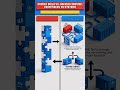
From satellite data → preprocessing → NDVI → pixel comparison → change detection → dashboard insights, this is the complete workflow behind GeoShift.
A quick breakdown of how AI and geospatial data turn satellite images into actionable intelligence.
Видео EP5 : How GeoShift Works: The Satellite AI Pipeline #aiprojects #geospatial #mlprojects #deep #tech канала Technical Insights
In this episode, I explain the GeoShift pipeline — how satellite imagery is processed, analyzed with machine learning, and converted into meaningful land-change insights.
From satellite data → preprocessing → NDVI → pixel comparison → change detection → dashboard insights, this is the complete workflow behind GeoShift.
A quick breakdown of how AI and geospatial data turn satellite images into actionable intelligence.
Видео EP5 : How GeoShift Works: The Satellite AI Pipeline #aiprojects #geospatial #mlprojects #deep #tech канала Technical Insights
Комментарии отсутствуют
Информация о видео
9 марта 2026 г. 13:00:42
00:00:47
Другие видео канала