- Популярные видео
- Авто
- Видео-блоги
- ДТП, аварии
- Для маленьких
- Еда, напитки
- Животные
- Закон и право
- Знаменитости
- Игры
- Искусство
- Комедии
- Красота, мода
- Кулинария, рецепты
- Люди
- Мото
- Музыка
- Мультфильмы
- Наука, технологии
- Новости
- Образование
- Политика
- Праздники
- Приколы
- Природа
- Происшествия
- Путешествия
- Развлечения
- Ржач
- Семья
- Сериалы
- Спорт
- Стиль жизни
- ТВ передачи
- Танцы
- Технологии
- Товары
- Ужасы
- Фильмы
- Шоу-бизнес
- Юмор
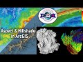
Slope Reclassification & Area Calculation in ArcGIS | Step-by-Step Tutorial
Slope Reclassification & Area Calculation in ArcGIS | Step-by-Step Tutorial
Learn how to create a slope reclassified map and calculate area in ArcGIS with this step-by-step GIS tutorial.
This video is designed to help GIS analysts and spatial data science professionals understand the process of slope analysis using ESRI's ArcGIS software.
We will cover the process of generating a slope map from a digital elevation model (DEM) and then reclassifying the slope into different categories. The tutorial also includes a section on area calculation using GIS, which is an essential skill for anyone working with remote sensing and geospatial data.
By the end of this tutorial, you will be able to create your own slope reclassified map and calculate the area of different slope categories, making you more proficient in raster analysis and GIS mapping. Whether you are a beginner or an experienced GIS professional, this video will provide you with the skills and knowledge you need to perform slope analysis and area calculation in ArcGIS, making you a more effective data analyst in the field of geospatial analysis and data science.
🔎your queries:-
Generating slope from DEM
Reclassifying slope into categories
Calculating area of each slope class (hectares & km²)
Practical formula for ArcGIS field calculator
how to calculate area
converte slope raster map into vector
how to combine various slope classes in to one class using dissolve tool
Geographical area calculation for slope map
cell size of study area
👉 If you found this video helpful, please Like, Share, Comment, and Subscribe for more GIS tutorials.
📲 Follow me on Instagram: https://www.instagram.com/georemotesensing/
Hashtags:-
#youtubepost #trending #ArcGIS #SlopeAnalysis #GIS #DEMTutorial #SlopeMap #ReclassifySlope #ArcGISTutorial #GISMapping #CalculateArea #RemoteSensing #WatershedManagement #georemotesensing #EnvironmentalStudies
[Thanks for watching]
Видео Slope Reclassification & Area Calculation in ArcGIS | Step-by-Step Tutorial канала Geo-RemoteSensing
Slope Reclassification arcgis arcgis slope calculation arcgis tutorial area calculation data data analysis data science dem dem analysis digital elevation model esri geography geospatial analysis gis gis analysis gis analyst gis mapping gis tutorial raster analysis reclassify slope arcgis remote sensing slope slope analysis slope calculation slope categories gis slope map slope map from dem slope map in arcgis spatial analysis spatial data science
Комментарии отсутствуют
Информация о видео
10 сентября 2025 г. 19:31:00
00:08:30
Другие видео канала