Evaluating rockfall frequency from natural slopes (multiple methods)
USGS Landslide Hazards Program Seminar Series, 20 October 2021.
Understanding of rockfall frequency-magnitude relationships is important for managing rockfall hazards, but characterizing these relationships is a challenging problem due to limited data, limited access, and the difficulty of accurately dating historic rockfalls. Developing frequency-magnitude relationships can be particularly difficult for natural rock slopes, which can still present significant hazards, but where data is often sparser due to greater distance from roads and buildings. This talk will provide an overview of the topic of rockfall frequency measurement by briefly discussing the relevant literature and presenting examples from the application of two different methods to the same study sites. The literature review will present a summary of methods previously applied to measuring rockfall frequency, including advantages and disadvantages of various approaches. The two case studies will come from original research in Glenwood Canyon, CO, an area where natural slopes present significant rockfall hazard to Interstate 70, but where previous knowledge of rockfall behavior consists mainly of the anecdotal insights gained by highway management personnel, without the benefit of systematic study. The first case study was conducted using lichenometry, and the second is based on an ongoing drone-based monitoring campaign. Comparisons between the results for the two methods will be made, and implications of these results for rockfall behavior in Glenwood Canyon will be discussed.
Graber A (2021). Evaluating rockfall frequency from natural slopes at multiple timescales using multiple methods; Examples from Glenwood Canyon, CO.
Video: https://www.usgs.gov/media/videos/evaluating-rockfall-frequency-natural-slopes-multiple-methods
Видео Evaluating rockfall frequency from natural slopes (multiple methods) канала USGS Presentations
Показать
Комментарии отсутствуют
Информация о видео
Другие видео канала
 Global Change Monitoring Portal: Pilot for the Southeast US
 Climate Change and Migratory Species Presentation (Jan 2009) -- Part 1 of 3
 High Resolution Climate Models to Benefit Avian Conservation
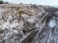 North Dakota landslide mapping: A complete inventory and mapping into the future
 Climate, Water Quality, Toxic Blooms of Golden Alga in Texas
 2017 October Evening Public Lecture — Global Trends in Mineral Commodity Supplies
 November Evening Public Lecture -- Waterbirds in a Changing Landscape
 Potential Corrosivity of Untreated Groundwater in the United States (Public Lecture)
 NextGen Water Data Update: Monitoring Location Pages & WaterAlert
 Towards an Internet of Water: Creating a community search index for water data
 WaterML2 Part 3: Surface Hydrology Features Conceptual Model and the Mainstems Logistical Data Model
 Global rainfall thresholds for urban landslides
 The building and upkeep of landslide hazards program: Blue Ridge perspective on a national challenge
 USACE Huntington Use of USGS Data and Services
 topoBuilder: OnDemand, Custom, Topographic Maps
 Landslide risk evaluation: tools and tips for risky decisions
 Post-fire debris flows in relation to observed rainfall anomalies: Dolan Fire, California
 Use of UASs (“Drones”) in 2018 at Kīlauea and Beyond
 Fish Habitat and Climate Change Part 1
 Climate Change, Mountain Pine Beetles, and Whitebark Pine
 Preparing for landslide disasters: Lessons learned from 20 years of USGS landslide response