Introducción a Google Earth Engine
Aprende a realizar combinación de bandas y descarga de una imagen satelital en Google Earth Engine
Sé un GiseroPro dominando Google Earth Engine en nuestro curso completo: https://www.mastergis.com/product/google-earth-engine/
¡Únete a nuestra comunidad de más de 10 000 alumnos en LATAM y España!
¡Síguenos y aprende mucho más!
Suscríbete a nuestro canal: https://bit.ly/3jtfw4i que se vienen más tutoriales.
➡Github: https://bit.ly/3DZq2vp
➡Facebook: http://bit.ly/2PuYdou
➡Instagram: https://bit.ly/3mOA3mE
➡Linkedin: http://bit.ly/2RtdNOW
➡Twitter: http://bit.ly/2yHsRBu.
#GoogleEarthEngine #MasterGIS
Видео Introducción a Google Earth Engine канала MasterGIS
Показать
Комментарии отсутствуют
Информация о видео
Другие видео канала
 Introducción a Google Earth Engine en QGIS
 Convertir correctamente Etiquetas de CAD a GIS con ArcGIS 10.6
 🌎 Google Earth Engine ⚙️¿Que es? Cómo Funciona? Español »INTRODUCCIÓN #01
 Crear curvas de nivel en Agisoft Metashape
 REPORTAJE AL PERU HUANCAVELICA 👉 TURISMO Y LUGARES TURISTICOS 👉 TOURS Y COMO LLEGAR A HUANCAVELICA
 Google Earth Engine -#01: Introducción
 Visualizar el relieve de una imagen en ArcGIS (crear DEM)
 SASPLANET Descargar imágenes de Google Earth, Maps (georeferenciadas) a ArcGIS | 2020
 🔵 Cómo usar GOOGLE EARTH online 2021
 ArcGIS Online - crea aplicaciones y mapas web
 🤓 REDES NEURONALES en GOOGLE EARTH ENGINE GEE Teledetección | MasterLive
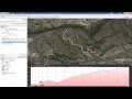 Cómo crear ruta a mano en Google Earth y exportarla a GPS o Wikiloc
 Tutorial AQLSGEE - Área quemada - Google Earth Engine APP
 Google Earth Engine -#02: Catalogo de datos e Workspace
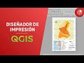 Diseñador de Impresión con QGIS
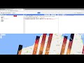 Landsat NDVI time-series in Google Earth Engine
 DELIMITAR CUENCA CON GLOBAL MAPPER Y GOOGLE EARTH
 Crear mapa de Impresión en ArcGIS
 Google Earth Engine #3: Explorer, Workspace guardar, compartir e descargar imagenes