- Популярные видео
- Авто
- Видео-блоги
- ДТП, аварии
- Для маленьких
- Еда, напитки
- Животные
- Закон и право
- Знаменитости
- Игры
- Искусство
- Комедии
- Красота, мода
- Кулинария, рецепты
- Люди
- Мото
- Музыка
- Мультфильмы
- Наука, технологии
- Новости
- Образование
- Политика
- Праздники
- Приколы
- Природа
- Происшествия
- Путешествия
- Развлечения
- Ржач
- Семья
- Сериалы
- Спорт
- Стиль жизни
- ТВ передачи
- Танцы
- Технологии
- Товары
- Ужасы
- Фильмы
- Шоу-бизнес
- Юмор
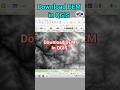
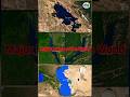
Download Rainfall Data form CHRS Data Portal #shorts #arcgis #rain
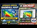
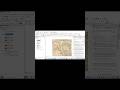
Learn how to download free rainfall data from the CHRS Data Portal for GIS and remote sensing projects. In this quick tutorial, I show you the exact steps to access, select, and download rainfall datasets for use in ArcMap, ArcGIS, and QGIS.
This is the first step for creating rainfall maps, interpolation maps, and spatial analysis in GIS.
Perfect for GIS beginners, geography students, and researchers working on rainfall analysis.
⚡ What You’ll Learn:
How to access CHRS Data Portal
How to select rainfall datasets
How to download GIS-ready data
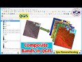
How to use rainfall data in ArcMap/QGIS
🚀 Watch Full Tutorial:
👉 Full Rainfall Map Tutorial – Link in Description
👍 Support the Channel
Like 👍 | Comment 💬 | Subscribe 🔔 for more GIS tutorials
@GeoRemoteSensing
#trendingnow #trendingvideo #viralvideo #arcgis #arcmap #remotesensing #rainfall #chrs #chrsdataportal #youtubeshorts #reelsviral #tutorial #learnwithme #explorepage #techreels #rainfalldata
Видео Download Rainfall Data form CHRS Data Portal #shorts #arcgis #rain канала Geo-RemoteSensing
This is the first step for creating rainfall maps, interpolation maps, and spatial analysis in GIS.
Perfect for GIS beginners, geography students, and researchers working on rainfall analysis.
⚡ What You’ll Learn:
How to access CHRS Data Portal
How to select rainfall datasets
How to download GIS-ready data
How to use rainfall data in ArcMap/QGIS
🚀 Watch Full Tutorial:
👉 Full Rainfall Map Tutorial – Link in Description
👍 Support the Channel
Like 👍 | Comment 💬 | Subscribe 🔔 for more GIS tutorials
@GeoRemoteSensing
#trendingnow #trendingvideo #viralvideo #arcgis #arcmap #remotesensing #rainfall #chrs #chrsdataportal #youtubeshorts #reelsviral #tutorial #learnwithme #explorepage #techreels #rainfalldata
Видео Download Rainfall Data form CHRS Data Portal #shorts #arcgis #rain канала Geo-RemoteSensing
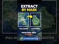
arcmap tutorial arcgis tutorial rainfall map arcmap average rainfall map gis tutorial for beginners raster calculator arcmap idw interpolation arcmap rainfall interpolation gis spatial analysis arcmap arcmap step by step tutorial create rainfall map arcgis arcgis raster analysis chrs rainfall data rainfall data gis interpolation methods gis raster to point arcmap arcmap full tutorial rainfall analysis using gis georemotesensing rainfall analysis idw gis
Комментарии отсутствуют
Информация о видео
29 апреля 2026 г. 19:30:25
00:00:47
Другие видео канала