Accurate Geospatial Intelligence from Drone Imagery with Esri & DJI
Site Scan for ArcGIS is an all-in-one drone mapping software. In this webinar learn more about how Esri worked with partner DJI in Site Scan for ArcGIS’s latest update: implementing the ability to geolocate video files coming from a DJI drone. Site Scan users are now able to leverage videos taken in Site Scan within the ArcGIS FMV toolbar to annotate, measure, and analyze the high-resolution drone footage along with existing GIS data. Now they can use off-the-shelf drone hardware to enrich their GIS in ways not available before!
---------------------------------------------------------------------------------------------------
Follow us on Social Media!
Twitter: https://twitter.com/Esri
Facebook: https://facebook.com/EsriGIS
LinkedIn: https://www.linkedin.com/company/esri
Instagram: https://www.instagram.com/esrigram
The Science of Where: http://www.esri.com
Видео Accurate Geospatial Intelligence from Drone Imagery with Esri & DJI канала ArcGIS
Показать
Комментарии отсутствуют
Информация о видео
Другие видео канала
 Ordnance Survey - Great Britain
 Build an ArcGIS Hub: Customizing Your Theme and Understanding the Workflow in ArcGIS Hub
 Color Coded Maps in Business Analyst
 What's New in the Data Loading Tools (September 2020)
 Ideas in ArcGIS Pro 2.4
 What's New in ArcGIS Survey123 (February 2022)
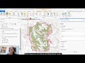 Map Trick: Manage and Share a Style in Minutes
 ArcGIS Mission Demo
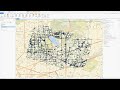 Investigative Support Using ArcGIS Pro Intelligence
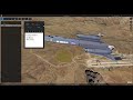 ArcGIS Earth 1.6 — What's New
 Build an ArcGIS Hub: Getting Your ArcGIS Hub Started
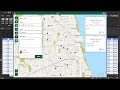 ArcGIS for Microsoft 365 - At a Glance
 ArcGIS Online: Time-Enable a Layer
 ArcGIS Insights: Adding Database Connectors
 ArcGIS Indoors: Space Planner
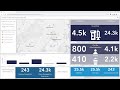 Managing COVID-19 Vaccine Inventory
 Edit like a Pro: Preserve Data Integrity Using ArcGIS Pro Map Topology
 ArcGIS Indoors: Configuring Meeting Room Reservations in ArcGIS Online
 Escondido: Running a Smarter City with Hub Technology
 Five Minutes with Layer Effects
 Exploring Relationships Between COVID-19 Rates and Socio-Demographic Variables