- Популярные видео
- Авто
- Видео-блоги
- ДТП, аварии
- Для маленьких
- Еда, напитки
- Животные
- Закон и право
- Знаменитости
- Игры
- Искусство
- Комедии
- Красота, мода
- Кулинария, рецепты
- Люди
- Мото
- Музыка
- Мультфильмы
- Наука, технологии
- Новости
- Образование
- Политика
- Праздники
- Приколы
- Природа
- Происшествия
- Путешествия
- Развлечения
- Ржач
- Семья
- Сериалы
- Спорт
- Стиль жизни
- ТВ передачи
- Танцы
- Технологии
- Товары
- Ужасы
- Фильмы
- Шоу-бизнес
- Юмор
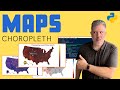
Interactive Wildland Fire Map in Python Using NASA/FIRMS Data - Hanceville, BC Example
In this episode I wanted to show you a quick sneak peek of some output from a project that I did on wildland fire. Not only did I plot data from NASA's Suomi satellite with VIIRS instruments, but I used deep learning to do a simple classification based on spread and confidence. You can see the shape of this one fire over time, and drill down to see individual fire areas each day. I trained the hotspot classification using five years of hotspot data across Canada. This video is shows a quick visualization of the results.
"We acknowledge the use of data and/or imagery from NASA's Fire Information for Resource Management System (FIRMS) (https://earthdata.nasa.gov/firms), part of NASA's Earth Observing System Data and Information System (EOSDIS)."
Disclaimer:
https://earthdata.nasa.gov/earth-observation-data/near-real-time/citation
Interested in transforming your career or finding your next gig?
https://system.billzone.com/careers.html
Want my team to do a project for you? Let's get to it!
https://system.billzone.com/smdeprojects.html
Want to get access to premium content made just for you and have a chat with me? Find me on Patreon :
https://www.patreon.com/mackenziedataengineering
Demo of my BZ RDP Cloaker:
https://www.patreon.com/posts/how-to-block-rdp-98471703?utm_medium=clipboard_copy&utm_source=copyLink&utm_campaign=postshare_creator&utm_content=join_link
Want to work with me 1:1? Contact me today and book your free 20 min consultation!
Contact form you can find at http://www.mackenziemackenzie.com/
Follow me on social media:
https://www.facebook.com/mackenziedataanalytics
https://twitter.com/seamacke
https://www.instagram.com/seamacke/
https://www.reddit.com/user/seamacke
https://www.linkedin.com/in/psmackenzie/
Get Microsoft Office including Access:
https://click.linksynergy.com/fs-bin/click?id=BdGJecFFM8A&offerid=1160033.10004289&type=3&subid=0
Got a YouTube Channel? I use TubeBuddy, it is awesome. Give it a try:
https://www.tubebuddy.com/seanmackenziedataengineering
#python #wildfire #openstreetmap
Видео Interactive Wildland Fire Map in Python Using NASA/FIRMS Data - Hanceville, BC Example канала Sean MacKenzie Data Engineering
Комментарии отсутствуют
Информация о видео
23 апреля 2022 г. 18:42:45
00:05:25
Другие видео канала