- Популярные видео
- Авто
- Видео-блоги
- ДТП, аварии
- Для маленьких
- Еда, напитки
- Животные
- Закон и право
- Знаменитости
- Игры
- Искусство
- Комедии
- Красота, мода
- Кулинария, рецепты
- Люди
- Мото
- Музыка
- Мультфильмы
- Наука, технологии
- Новости
- Образование
- Политика
- Праздники
- Приколы
- Природа
- Происшествия
- Путешествия
- Развлечения
- Ржач
- Семья
- Сериалы
- Спорт
- Стиль жизни
- ТВ передачи
- Танцы
- Технологии
- Товары
- Ужасы
- Фильмы
- Шоу-бизнес
- Юмор
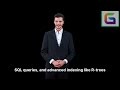
Quantum Geospatial Transforming GIS and Earth Observation Workflows
Quantum geospatial computing is emerging as a revolutionary technology that combines quantum computing, geospatial information systems (GIS), Earth observation (EO), remote sensing, and artificial intelligence (AI) to solve complex spatial problems at unprecedented speeds. As global geospatial datasets continue to grow through high-resolution satellites, LiDAR, UAV mapping, and real-time telemetry, traditional computing systems are increasingly challenged by the scale and complexity of spatial analytics. Quantum computing offers a powerful alternative capable of handling massive geospatial workloads more efficiently than classical high-performance computing systems.
Unlike traditional computers that process information using binary bits, quantum computers use qubits that leverage superposition, entanglement, and quantum interference. These properties enable quantum systems to perform certain calculations exponentially faster, making them highly valuable for geospatial applications such as spatial-temporal simulation, satellite image classification, terrain modeling, sensor fusion, climate forecasting, and route optimization.
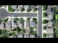
Quantum geospatial systems are expected to improve decision-making speed, analytical accuracy, and scalability for industries developing digital twins, smart cities, environmental intelligence platforms, defense systems, and next-generation geospatial infrastructures. Key applications include optimizing logistics and transportation networks, emergency response planning, telecommunications coverage, autonomous mobility systems, and satellite scheduling operations.
Quantum Machine Learning (QML) is becoming an important part of geospatial AI workflows. QML can accelerate feature extraction, anomaly detection, and classification tasks for large Earth observation datasets. Major applications include land-use classification, disaster impact assessment, precision agriculture, urban growth forecasting, and satellite object detection. Quantum-enhanced AI models may significantly reduce training time while improving predictive accuracy.
Quantum optimization also has major implications for GIS operations. Complex routing and resource allocation problems that traditionally require enormous computational power can be solved more efficiently using quantum algorithms. This is especially useful for supply chain optimization, drone delivery networks, fleet routing, maritime navigation, and smart city traffic management.
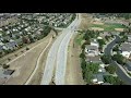
Remote sensing analytics is another area expected to benefit greatly from quantum technologies. Quantum-powered systems may accelerate hyperspectral analysis, SAR image interpretation, atmospheric correction, vegetation analysis, and multi-sensor data fusion. These improvements will strengthen climate science, environmental monitoring, and disaster management capabilities.
Quantum simulation could also transform climate and Earth system modeling. By processing highly complex environmental interactions more efficiently, quantum systems may improve weather forecasting, flood prediction, wildfire propagation analysis, glacier melt simulation, ocean circulation modeling, and carbon cycle analysis. These advancements could provide more accurate environmental intelligence for governments and organizations worldwide.
The future of geospatial intelligence will be driven by the convergence of quantum computing, GeoAI, Earth observation, digital twins, cloud computing, and edge analytics. Together, these technologies will enable real-time planetary monitoring, autonomous geospatial systems, intelligent environmental prediction, and adaptive geospatial decision support.
[GeoWGS84.ai](https://geowgs84.ai?utm_source=chatgpt.com) is among the platforms exploring advanced geospatial innovation through AI-enhanced analytics, scalable Earth observation pipelines, digital twin systems, climate-risk modeling, and next-generation geospatial infrastructure. By integrating AI, remote sensing, cloud GIS, and future quantum architectures, such platforms are positioning themselves for the next era of spatial intelligence.
Quantum geospatial computing is no longer just an experimental concept. As geospatial data and AI models continue to grow in complexity, quantum technologies are expected to become essential for large-scale environmental intelligence, smart infrastructure management, climate resilience, and ultra-fast spatial analytics. Organizations investing early in quantum GIS and geospatial R&D will likely play a major role in shaping the future of global geospatial innovation.
https://www.geowgs84.ai/post/quantum-geospatial-transforming-gis-and-earth-observation-workflows
Видео Quantum Geospatial Transforming GIS and Earth Observation Workflows канала GeoWGS84 Corp.
Unlike traditional computers that process information using binary bits, quantum computers use qubits that leverage superposition, entanglement, and quantum interference. These properties enable quantum systems to perform certain calculations exponentially faster, making them highly valuable for geospatial applications such as spatial-temporal simulation, satellite image classification, terrain modeling, sensor fusion, climate forecasting, and route optimization.
Quantum geospatial systems are expected to improve decision-making speed, analytical accuracy, and scalability for industries developing digital twins, smart cities, environmental intelligence platforms, defense systems, and next-generation geospatial infrastructures. Key applications include optimizing logistics and transportation networks, emergency response planning, telecommunications coverage, autonomous mobility systems, and satellite scheduling operations.
Quantum Machine Learning (QML) is becoming an important part of geospatial AI workflows. QML can accelerate feature extraction, anomaly detection, and classification tasks for large Earth observation datasets. Major applications include land-use classification, disaster impact assessment, precision agriculture, urban growth forecasting, and satellite object detection. Quantum-enhanced AI models may significantly reduce training time while improving predictive accuracy.
Quantum optimization also has major implications for GIS operations. Complex routing and resource allocation problems that traditionally require enormous computational power can be solved more efficiently using quantum algorithms. This is especially useful for supply chain optimization, drone delivery networks, fleet routing, maritime navigation, and smart city traffic management.
Remote sensing analytics is another area expected to benefit greatly from quantum technologies. Quantum-powered systems may accelerate hyperspectral analysis, SAR image interpretation, atmospheric correction, vegetation analysis, and multi-sensor data fusion. These improvements will strengthen climate science, environmental monitoring, and disaster management capabilities.
Quantum simulation could also transform climate and Earth system modeling. By processing highly complex environmental interactions more efficiently, quantum systems may improve weather forecasting, flood prediction, wildfire propagation analysis, glacier melt simulation, ocean circulation modeling, and carbon cycle analysis. These advancements could provide more accurate environmental intelligence for governments and organizations worldwide.
The future of geospatial intelligence will be driven by the convergence of quantum computing, GeoAI, Earth observation, digital twins, cloud computing, and edge analytics. Together, these technologies will enable real-time planetary monitoring, autonomous geospatial systems, intelligent environmental prediction, and adaptive geospatial decision support.
[GeoWGS84.ai](https://geowgs84.ai?utm_source=chatgpt.com) is among the platforms exploring advanced geospatial innovation through AI-enhanced analytics, scalable Earth observation pipelines, digital twin systems, climate-risk modeling, and next-generation geospatial infrastructure. By integrating AI, remote sensing, cloud GIS, and future quantum architectures, such platforms are positioning themselves for the next era of spatial intelligence.
Quantum geospatial computing is no longer just an experimental concept. As geospatial data and AI models continue to grow in complexity, quantum technologies are expected to become essential for large-scale environmental intelligence, smart infrastructure management, climate resilience, and ultra-fast spatial analytics. Organizations investing early in quantum GIS and geospatial R&D will likely play a major role in shaping the future of global geospatial innovation.
https://www.geowgs84.ai/post/quantum-geospatial-transforming-gis-and-earth-observation-workflows
Видео Quantum Geospatial Transforming GIS and Earth Observation Workflows канала GeoWGS84 Corp.
Комментарии отсутствуют
Информация о видео
7 ч. 13 мин. назад
00:01:01
Другие видео канала