Openlayers 6: Styling Vector data (Markers, Choropleth and Proportional Circles map on WebGIS)
This video shows how to create Markers, Chloropleth and Proportional Circles map on WebGIS using Openlayers6 without any server side dependencies.
You will learn how to created basic webgis Page using Openlayers and also how to overlay and style your data using openlayers only.
Time Line of Video
00:00 - Introduction
02:35 - Openlayers 6 and Layerswitcher Libraries download
04:09 - Basic openlayers WebGIS Application coding (Adding Basemap and Layerswitcher)
16:30 - Add markers to the WebGIS
42:40 - Generate Chloropleth style
49:02 - Generate Proportional Circles style
Link of the source code shown in the tutorial:
https://drive.google.com/file/d/1Poxd8kLYvfN5DJYwPVexnyGpIJVcuHYY/view?usp=sharing
Видео Openlayers 6: Styling Vector data (Markers, Choropleth and Proportional Circles map on WebGIS) канала OpenGeo Lab
Показать
Комментарии отсутствуют
Информация о видео
Другие видео канала
 Watching the Earth breathe: Seasonal Vegetation Time lapse for the last two decades (2000 to 2021)
 QGIS For Absolute Beginners
 WebGIS development Add Query panel (Feature query Tool) to WebGIS page - part 3
 3d visualization using gvsig software.avi
 Machine learning (ML) based Image Classification in Google Earth Engine (GEE) using Sentinel-2 data
 Installation of gvsig software.avi
 Geoserver: Publish Cloud Optimized GeoTIFF(COG) hosted on AWS S3 in Geoserver
 WebGIS application development using Openlayers 6 and Geoserver-part2 (Featureinfo and Measure Tool)
 ESRI 2020 Land Cover data: Download and use in Google Earth engine
 Google Earth Engine - Browse, Visualize and Download Landsat 9 data
 PyScript - Run Python in the Browser !
 WebGIS Application development (feature editing on web)using Geoserver, Openlayers, GeoExt, Postgis
 WebGIS dashboard without any programming/Coding using MapStore framework and Geoserver - part 2
 Google Earth Engine: Estimate and map Crop sown area using Sentinel-2 Multi-Temporal data
 Google Earth Engine : Analyse Impact of Heat wave/High Temperature on Crop Growth using NDVI & LST
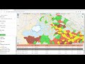 WebGIS app development using Openlayers-6 & Geoserver-Pt3 (Query panel using WMS & WFS service)
 Geoserver: Feature Editing on WebGIS using Geoserver(WFS-T service) and Openlayers
 WebGIS: Create fast cached Web Map using Geoserver, GeoWebCache, & AWS (S3 Bucket) as storage medium
 Develop simple Web GIS application using Geoserver, Openlayers, Geoext and postgis - part1
 Google Earth Engine -Spectral signature extraction from Sentinel-2 Data
 Install Geoserver with Tomcat(GIS server and Webserver)