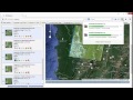
Landsat mosaic with ArcGIS 10 1
The piece of ripped Landsat can be mosaicked together by using ArcGIS. These piece of ripped image of Landsat can be mosaicked by two step; i). you need to create the mosaic to new raster then will get new shapefile of new raster from the mosaic; ii) you need to go to find "Mosaic" in tooblox and do it similar to i) above, but out put raster you have to upload the mosaic new raster above
Видео Landsat mosaic with ArcGIS 10 1 канала Yav Net
Видео Landsat mosaic with ArcGIS 10 1 канала Yav Net
Показать
Комментарии отсутствуют
Информация о видео
Другие видео канала
 Clase - Mosaico LandSat en ArcGIS
 Crear Poligono En ArcGis | Crear Shape Con Coordenadas|Tutorial Arcgis
 ArcGIS - Creating Contours from Rasters in ArcMap
 Layout preparation in Arc GIS and exporting in JPEG
 Mosaic - Mosaic or Combine or Stitch Two Images in ERDAS Imagine
 How to digitize automatic a scanned topographic map with ArcGIS
 How to Create Contours from a Raster in ArcGIS || Contours Lines from DEM in ArcGIS
 Automatic raster to vector conversion in ArcGIS - part1
 Flood Prone Areas using ArcGIS
 NDVI - Normalized Difference Vegetation Index || calculate NDVI using ArcGIS
 Fix Landsat 7 Scan Line Error using Landsat Toolbox in ArcMap
 Mosaic to new raster tutorial
 GROUND WATER POTENTIAL ZONE MAPPING
 Generate Landsat-8 Apparent Surface Reflectance in ArcGIS
 Create Slope and Hillshade Map for Digital Elevation Model (SRTM Raster Data) in ArcGIS 10.xx
 Automatic Map Digitization (Vectorization) using ArcGIS (ArcMap) || Raster to Vector
 GIS Tutorial | Part 6 | How to create topographic base maps | Study area mapping | ArcGIS Tutorials
 Automatic digitizing on ArcGIS using ArcScan toolbar
 How to georeference jpeg image map in arcmap part 1
![12_LabGIS[ArcGIS]ตัวอย่างการวิเคราะห์พื้นที่รับน้ำ(watershp)](https://i.ytimg.com/vi/pktjNAJYxFs/default.jpg) 12_LabGIS[ArcGIS]ตัวอย่างการวิเคราะห์พื้นที่รับน้ำ(watershp)
12_LabGIS[ArcGIS]ตัวอย่างการวิเคราะห์พื้นที่รับน้ำ(watershp)