- Популярные видео
- Авто
- Видео-блоги
- ДТП, аварии
- Для маленьких
- Еда, напитки
- Животные
- Закон и право
- Знаменитости
- Игры
- Искусство
- Комедии
- Красота, мода
- Кулинария, рецепты
- Люди
- Мото
- Музыка
- Мультфильмы
- Наука, технологии
- Новости
- Образование
- Политика
- Праздники
- Приколы
- Природа
- Происшествия
- Путешествия
- Развлечения
- Ржач
- Семья
- Сериалы
- Спорт
- Стиль жизни
- ТВ передачи
- Танцы
- Технологии
- Товары
- Ужасы
- Фильмы
- Шоу-бизнес
- Юмор
2004 Tsunami || #shorts #asia #india #map #mapping
The data is not 100% accurate.
Source: Gemini
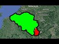
The 2004 Indian Ocean tsunami, triggered by a magnitude 9.1 earthquake off the coast of Sumatra, devastated coastal regions across several countries as the waves radiated outward. Hardest-hit areas spanned from Indonesia’s Aceh province to Sri Lanka, coastal India (particularly Tamil Nadu and the Andaman and Nicobar Islands), Thailand, and the Maldives. [
The devastating December 26, 2004 event was driven by a 1200 km rupture of the Sunda megathrust fault. Because of this massive geographic fault line, the tsunami waves traveled rapidly both east and west across the Indian Ocean, ultimately affecting shorelines as far away as Somalia, Kenya, and Tanzania. Coastal topographies—such as the seafloor gradient and offshore coral reefs—amplified the destructive run-up in certain regions, resulting in varying levels of devastation along different coastlines. Detailed geographical data, including the epicenter of the megathrust earthquake and the varying heights of the tsunami run-ups across these affected regions, can be further examined on the U.S. Geological Survey 2004 Sumatra Earthquake & Tsunami Maps or through the National Oceanic and Atmospheric Administration's 2004 Tsunami Overview.
@The_Asian_Mapper
Видео 2004 Tsunami || #shorts #asia #india #map #mapping канала Ishaan Mapz
Source: Gemini
The 2004 Indian Ocean tsunami, triggered by a magnitude 9.1 earthquake off the coast of Sumatra, devastated coastal regions across several countries as the waves radiated outward. Hardest-hit areas spanned from Indonesia’s Aceh province to Sri Lanka, coastal India (particularly Tamil Nadu and the Andaman and Nicobar Islands), Thailand, and the Maldives. [
The devastating December 26, 2004 event was driven by a 1200 km rupture of the Sunda megathrust fault. Because of this massive geographic fault line, the tsunami waves traveled rapidly both east and west across the Indian Ocean, ultimately affecting shorelines as far away as Somalia, Kenya, and Tanzania. Coastal topographies—such as the seafloor gradient and offshore coral reefs—amplified the destructive run-up in certain regions, resulting in varying levels of devastation along different coastlines. Detailed geographical data, including the epicenter of the megathrust earthquake and the varying heights of the tsunami run-ups across these affected regions, can be further examined on the U.S. Geological Survey 2004 Sumatra Earthquake & Tsunami Maps or through the National Oceanic and Atmospheric Administration's 2004 Tsunami Overview.
@The_Asian_Mapper
Видео 2004 Tsunami || #shorts #asia #india #map #mapping канала Ishaan Mapz
Комментарии отсутствуют
Информация о видео
18 июня 2026 г. 10:07:28
00:00:13
Другие видео канала


![Collab (Soviet Mapping might be a little late) [NOTE IN DESCRIPTION] #map #geography](https://i.ytimg.com/vi/l2g5N63Lll0/default.jpg)