PCI Geomatics Webinar | Automated Object Based Image Classification Using Geomatica
PCI Geomatics presents this must-see webinar that showcases the newest capabilities of Geomatica, a powerful, streamlined, image-processing platform for aerial, UAV, and satellite imagery. The webinar focuses specifically on the newest capabilities that have been added to Geomatica. A deep dive on the Object Analyst automation capability will be provided.
Видео PCI Geomatics Webinar | Automated Object Based Image Classification Using Geomatica канала CATALYST. Earth
Видео PCI Geomatics Webinar | Automated Object Based Image Classification Using Geomatica канала CATALYST. Earth
Показать
Комментарии отсутствуют
Информация о видео
Другие видео канала
 Geomatica Tutorials - RGB Channel mapping and Visualization in Focus
 PCI Geomatics Webinar | Full Aerial Image Processing Workflow with PhaseOne Industrial
 GreenValley Webinar: Extracting Individual Tree Metrics from LiDAR Data
 Automated Change Detection with Geomatica and SAR Imagery (Part 3)
 Stereo DEM Extraction from SAR imagery - RADARSAT-2 (Part 2)
 Automated Object Based Image Feature Extraction
 OBIA with Geomatica Object Analyst - NAIP 4 band imagery Classification
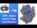 object based image classification workflow in Orfeo Toolbox
 Geomatica - High Quality DEM Extraction
 Deep learning for nationwide building extraction from aerial imagery
 eCognition Image Analysis: Jarlath O'Neil-Dunne at eCognition User Summit (Part 2/2)
 Sentinel-1: Stacking imagery and visual change analysis
 Fast, accurate and highly automated Atmospheric Correction
 Stereo DEM Extraction from SAR imagery - RADARSAT-2 (Part 1)
 Lineament Mapping using GIS and Geomatica
 Assemble and pan-sharpen WorldView-2 imagery
 Aerial Survey Image Processing Solutions that Scale with your Business
 Automatic Cloud Detection and Haze Removal in Geomatica
 Pansharpen and Mosaic Landsat-8 imagery with Geomatica
 Continuous space based surveying and monitoring for detecting mm movements on the ground