REDcatch UAV GNSS L1 L2 Upgrade Kit (PPK) with REDtoolbox and Agisoft
REDcatchs UAV upgrade kit contains the ublox ZED9F chipset for direct georeferencing (without GCP / passpoints) applications. How accurate this kit is and how to process the GNSS and image data with Agisoft Metashape photogrammetry software is described in the video
Видео REDcatch UAV GNSS L1 L2 Upgrade Kit (PPK) with REDtoolbox and Agisoft канала REDcatch GmbH
Видео REDcatch UAV GNSS L1 L2 Upgrade Kit (PPK) with REDtoolbox and Agisoft канала REDcatch GmbH
Показать
Комментарии отсутствуют
Информация о видео
Другие видео канала
 Processing DJI Phantom 4 RTK photos in Agisoft Metashape
 REDtoolbox - Batch Shift RTK coordinate for multiple JPG images
 Introducing the 3D ImageVector - The GNSS camera IMU
 FOTOGRAMETRÍA: RTKLIB - DRONE PPK - INTERPOLACIÓN METADATOS - GEOETIQUETADO - PIX4D
 Tutorial: GNSS PPK and geotagging images for EMLID Reach devices - Using REDtoolbox software
 WEBINAR Metodología de Referenciación PPK en plataformas UAS - BMP Renta
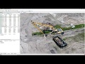 Agisoft Metashape Tutorial - Full Processing from photos to dense cloud - with Ground Control Points
 Primitive Technology: Chimney and pots
 DroneCamp 2020: Drone Imagery Processing with Agisoft Metashape
 Online workshop "TOPODRONE LiDAR data processing"
 Primitive technology: searching for groundwater and water filter (water well and tank) full
 How to create an Orthomosaic for a user defined view direction in Agisoft Metashape
 Collect and post process Ground Control Points (GCP's) using Emlid Reach RS and EZsurv
 Tutorial: DJI Phantom 4 RTK - GNSS Postprocessing and Geotagging Software
 Agisoft Metashape orthophotomap processing workflow with GCPs
 Agisoft Photoscan: Generating Orthomosaics from Aerial Photography
 FOTOGRAMETRIA CON PHANTOM 4 RTK/PPK
 TUTORIAL - KIT PPK GUANDALINI PARA DRONE DJI PHANTOM 4 PRO E ADVANCED
 QGIS Volume Calculation Tool - Plugin Tutorial
 Placing Ground Control Point Markers in Agisoft Metashape