Seeing Satellite Benefits on the Ground with the National Park Service
From the hoodoos in Bryce Canyon to the caves of Carlsbad Caverns and the giant sequoias of Yosemite, did you know researchers use NASA satellite data in National Parks?
Our view from space can help monitor water resources, assess air quality, analyze fire patterns, track vegetation changes, and more. It all helps the National Park Service make informed decisions for protecting and restoring America’s most beautiful natural spaces.
This video can be freely shared and downloaded. While the video in its entirety can be shared without permission, the music and some individual imagery may have been obtained through permission and may not be excised or remixed in other products.
For more information on NASA’s media guidelines, visit https://nasa.gov/multimedia/guidelines.
Видео Seeing Satellite Benefits on the Ground with the National Park Service канала NASA Video
Показать
Комментарии отсутствуют
Информация о видео
Другие видео канала
 Sector 33 Mobile App
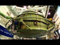 Orion MPCV: The Journey Begins
 NASA SpaceX Crew 3 Leaders Discuss Mission Overview - October 6, 2021
 Space Shuttle Era: Imagery
 Expedition 56 Year of Education on Station Wrap Up Event
 Asteroid Redirect Mission: Concept Highlights
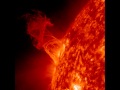 SDO Sees Solar Ballet
 MAVEN Magnetometer
 Flying Fast, Flying Quiet
 NASA HRP One-Year Mission: Physical Performance
 OSIRIS-REx Departs Bennu and Delivers Sample
 James Fraction, Electrical Engineer
 NASA UTM: A Giant Leap for Air Transportation
 (Video 8 of 8) Omics: Advancing Personalized Medicine from Space to Earth
 NASA Ames Helps SpaceX Develop Dragon's Heat Shield
 Expedition 67 NASA’s SpaceX Crew-3 Hatch Closure on Space Station - May 4, 2022
 Magnetar Giant Flare Produces Gamma Rays
 HARP Citizen Science Project
 NASA’s Lucy Mission Extends its Solar Arrays
 Crew 3 Crew News Conference - October 7, 2021
 Tahani Amer