Vegetation Management Solutions
Flight Evolved acquisition teams deploy UAV and helicopter LiDAR platforms to acquire data for electric utility companies to create vegetation management solutions. This improves efficiency over traditional identification methods during the assignment of ground crews and provides end users accurate clearance analysis, grow-in, and fall-in models.
Видео Vegetation Management Solutions канала Quantiscan
Видео Vegetation Management Solutions канала Quantiscan
Показать
Комментарии отсутствуют
Информация о видео
Другие видео канала
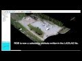 Colorizing LiDAR Data with Orthomosaic RGB
 California Fire Season Utility Inspections
 Flight Evolved LiDAR Acquisition Process
 LiDAR Scanning | Backpack Mount, UAV, Helicopter
 Scan to BIM with the Riegl VZ-400i
 Helicopter LiDAR R&D Scanning | Flight Evolved
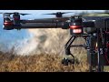 LiDAR Drones for Fire Prevention
 Flight Evolved 3D Mapping Modeling Services Demo Reel
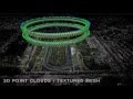 Aerial 3D Mapping and 3D Modeling Demo Reel 2015
 Photorealistic 3D Modeling
 UAV LiDAR | Drones for Electric Utilities
 Tarot 650 Sport Build Installation Instructions DIY Quadcopter
 Montana Aerial Video Showreel - Flight Evolved 2015
 LiDAR Rover
 Happy Holidays from FE!
 Visual and Thermal 3D Animations