- Популярные видео
- Авто
- Видео-блоги
- ДТП, аварии
- Для маленьких
- Еда, напитки
- Животные
- Закон и право
- Знаменитости
- Игры
- Искусство
- Комедии
- Красота, мода
- Кулинария, рецепты
- Люди
- Мото
- Музыка
- Мультфильмы
- Наука, технологии
- Новости
- Образование
- Политика
- Праздники
- Приколы
- Природа
- Происшествия
- Путешествия
- Развлечения
- Ржач
- Семья
- Сериалы
- Спорт
- Стиль жизни
- ТВ передачи
- Танцы
- Технологии
- Товары
- Ужасы
- Фильмы
- Шоу-бизнес
- Юмор
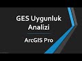
ArcGIS Pro ModelBuilder Tutorial: Solar Power Plant (SPP) Site Suitability Analysis
ModelBuilder is a visual programming tool in ArcGIS that allows users to create, automate and manage geoprocessing workflows without writing code.
In this step-by-step ArcGIS Pro tutorial, we build a complete Site Suitability Analysis model from scratch using ModelBuilder. We will determine the most suitable locations for a Solar Power Plant (SPP) installation within a specific basin boundary based on four criteria.
Whether you are a student, researcher, or GIS professional, mastering ModelBuilder will allow you to automate your workflows, eliminate repetitive tasks, and build fully reusable spatial analysis tools.
📌 WHAT YOU WILL LEARN IN THIS VIDEO:
• How to initialize a model and configure environment settings (Output Coordinate System, Extent, and Mask).
• Deriving secondary surface data (Slope in % rise and Aspect) from a raw Digital Elevation Model (DEM).
• Calculating continuous proximity buffers using the Euclidean Distance tool.
• Setting up Raster Analysis environments perfectly using Mask and Snap Raster to guarantee edge-to-edge pixel alignment.
• Using Conditional Logic (Con tools) and Map Algebra to execute a Boolean (binary) suitability overlay.
⏱️ TIMESTAMPS:
0:00 - Introduction
3:54 - Project Criteria Overview
5:41 - Setting up ModelBuilder & Environment Settings
7:43 - Criterion 1 - Used Elevation data with Con tool
11:19 - Criterion 2 - Used Slope and Con tools
14:35 - Criterion 3 - Used Aspect and Con tools
17:34 - Criterion 4 - Used Euclidean Distance and Con tools
22:56 - Overlay Analysis using Raster Calculator
26:27 - Extract by Mask to clip out study area
27:54 - Raster to Polygon tool
32:02 - Calculate Field
34:19 - Select tool
37:24 - Symbology
38:40 - ModelBuilder Parameters
⚙️ THE CRITERIA USED IN THIS EXERCISE:
1. Elevation: 500 m ≤ Suitable ≤ 1000 m
2. Slope: Flat terrain preferred (Suitable ≤ 10%)
3. Aspect: South-facing orientation (135° ≤ Suitable ≤ 225°)
4. Proximity: Distance to settlements must be ≥ 1 km (1000 meters)
💬 Let me know in the comments below: What other datasets would you add to this model for a real-world solar project? (e.g., proximity to the electrical grid, soil maps, protected land boundaries?)
If this video helped you master spatial modeling workflows in ArcGIS Pro, please give it a LIKE and SUBSCRIBE to the channel for more advanced GIS tutorials!
#ArcGISPro #ModelBuilder #GIS #SpatialAnalysis #SolarEnergy #MapAlgebra #GeographicInformationSystems #ArcGIS #Tutorial
Видео ArcGIS Pro ModelBuilder Tutorial: Solar Power Plant (SPP) Site Suitability Analysis канала CodeSpatial
Комментарии отсутствуют
Информация о видео
9 июня 2026 г. 19:03:40
00:41:07
Другие видео канала