Monitoring of slopes and landslide areas – Leica Geosystems Monitoring Solutions
Stay informed and stay safe with our comprehensive environmental monitoring solutions for landslides. With advanced technology and accurate data analysis, you can be confident in your landslide risk management strategy. Explore our capabilities now: https://hxgn.biz/3JoxK5Z
#GrowWithMonitoring #LandslideMonitoring #Monitoring Solutions #LeicaGeosystems
Видео Monitoring of slopes and landslide areas – Leica Geosystems Monitoring Solutions канала Leica Geosystems AG
#GrowWithMonitoring #LandslideMonitoring #Monitoring Solutions #LeicaGeosystems
Видео Monitoring of slopes and landslide areas – Leica Geosystems Monitoring Solutions канала Leica Geosystems AG
Показать
Комментарии отсутствуют
Информация о видео
Другие видео канала
 Digitales Planhaus: Zusammenspiel der Lösungen im Projekt "unique" für das Thermoplan-Werk in Weggis
 Leica Geosystems Construction Tools - Verwendung des Leica Rugby 680 Rotationslasers
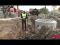 Leica Zeno Mobile One - For iOS & Android
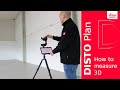 Leica DISTO™ Plan App: How to measure 3D?
 Leica CountryMapper Hybrid Airborne Sensor
 Hercal GS18 I con CCP activo
 Egartop GS18 I con CCP activo
 Real-Time Surface Logging: Unleashing Cutting-Edge Technology
 Leica iCON – Understanding Construction
 Crime in the field - How surveyor saved scads of money with LOC8
 Monitoring of large-scale infrastructure – Leica Geosystems Monitoring Solutions
 30 YEARS LEICA DISTO AND 3D MEASURING
 30 Years DISTO History
 Monitoring for dams and reservoirs – Leica Geosystems Monitoring Solutions
 Geomatic Breakfast Feedback
 Geomatic Breakfasts CPEC
 Testing Leica AP20 AutoPole for the first time - Building construction | GAUTSCHI, Switzerland
 Leica Captivate v7.51: What`s new in the software release - AP20, MS60 & GNSS
 Leica Zeno Mobile & GS18T – powered by Smart Positioning
 Leica 3D Disto: Countertop Digital Templating (teaser)