Earth's Land Formations - More Real World Science on the Learning Videos Channel
With HD footage from all over the world, this program shows students all the various types of landforms found on our planet. Animation segments demonstrate how land formations are created by movement of the earth's plates, volcanoes, weather and erosion.
Land, sometimes referred to as dry land, is the solid surface of Earth that is not permanently covered by water. The vast majority of human activity throughout history has occurred in land areas that support agriculture, habitat, and various natural resources. Some life forms (including terrestrial plants and terrestrial animals) have developed from predecessor species that lived in bodies of water.
Areas where land meets large bodies of water are called coastal zones. The division between land and water is a fundamental concept to humans. The demarcation between land and water can vary by local jurisdiction and other factors. A maritime boundary is one example of a political demarcation. A variety of natural boundaries exist to help clearly define where water meets land. Solid rock landforms are easier to demarcate than marshy or swampy boundaries, where there is no clear point at which the land ends and a body of water has begun. Demarcation can further vary due to tides and weather.
"Land area" (also known as "land mass") refers to the total surface area of the land of a geographical region or country (which may include discontinuous sections of land such as islands).
A volcano is a rupture in the crust of a planetary-mass object, such as Earth, that allows hot lava, volcanic ash, and gases to escape from a magma chamber below the surface.
Earth's volcanoes occur because its crust is broken into 17 major, rigid tectonic plates that float on a hotter, softer layer in its mantle. Therefore, on Earth, volcanoes are generally found where tectonic plates are diverging or converging, and most are found underwater. For example, a mid-oceanic ridge, such as the Mid-Atlantic Ridge, has volcanoes caused by divergent tectonic plates whereas the Pacific Ring of Fire has volcanoes caused by convergent tectonic plates. Volcanoes can also form where there is stretching and thinning of the crust's plates, e.g., in the East African Rift and the Wells Gray-Clearwater volcanic field and Rio Grande Rift in North America. This type of volcanism falls under the umbrella of "plate hypothesis" volcanism. Volcanism away from plate boundaries has also been explained as mantle plumes. These so-called "hotspots", for example Hawaii, are postulated to arise from upwelling diapirs with magma from the core–mantle boundary, 3,000 km deep in the Earth. Volcanoes are usually not created where two tectonic plates slide past one another.
In earth science, erosion is the action of surface processes (such as water flow or wind) that removes soil, rock, or dissolved material from one location on the Earth's crust, and then transports it to another location (not to be confused with weathering which involves no movement). This natural process is caused by the dynamic activity of erosive agents, that is, water, ice (glaciers), snow, air (wind), plants, animals, and humans. In accordance with these agents, erosion is sometimes divided into water erosion, glacial erosion, snow erosion, wind (aeolic) erosion, zoogenic erosion, and anthropogenic erosion. The particulate breakdown of rock or soil into clastic sediment is referred to as physical or mechanical erosion; this contrasts with chemical erosion, where soil or rock material is removed from an area by its dissolving into a solvent (typically water), followed by the flow away of that solution.
Plate tectonics is a scientific theory describing the large-scale motion of seven large plates and the movements of a larger number of smaller plates of the Earth's lithosphere, since tectonic processes began on Earth between 3.3 and 3.5 billion years ago. The model builds on the concept of continental drift, an idea developed during the first decades of the 20th century.
The lithosphere, which is the rigid outermost shell of a planet (the crust and upper mantle), is broken into tectonic plates. The Earth's lithosphere is composed of seven or eight major plates (depending on how they are defined) and many minor plates. Where the plates meet, their relative motion determines the type of boundary: convergent, divergent, or transform. Earthquakes, volcanic activity, mountain-building, and oceanic trench formation occur along these plate boundaries (or faults). The relative movement of the plates typically ranges from zero to 100 mm annually.
Видео Earth's Land Formations - More Real World Science on the Learning Videos Channel канала Harmony Square
Показать
Комментарии отсутствуют
Информация о видео
Другие видео канала
 Exploring Landforms and Bodies of Water for Kids - FreeSchool
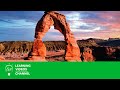 Earth & Land Formations - Real World Science on the Learning Videos Channel
 Landforms for Kids | Learn about the 4 Types of Landforms
 Learning About Landforms | Types of Landforms | Facts for Kids
 Exploring the Arctic for Kids: Arctic Animals and Climates for Children - FreeSchool
 Landforms, Hey!: Crash Course Kids #17.1
 55 Geographical Terms You Must Know - Let's Talk Geography on the Learning Videos Channel
 Habitats for Kids | Kids learn about Tundra, Desert, Grasslands, Forests and More | Science for Kids
 LANDFORMS | Types Of Landforms | Landforms Of The Earth | The Dr Binocs Show | Peekaboo Kidz
 A Little Spot of Courage 📚Kid Books Read Aloud | A Story about Being Brave during the Pandemic
 Ecosystems and Biomes | Kids Learn About Ecosystems and Biomes | Real World Science Videos
 Types of Landforms | Landforms | Video for Kids
 Fossils & Dinosaurs - Real World Science on the Learning Videos Channel
 Volcanoes for Kids | A fun and engaging introduction to volcanoes for children
 Learning About Nature On A Hike With Blippi | Educational Videos For Kids
 Maps & Globes - Let's Talk Geography on the Learning Videos Channel
 Where Do Mountains Come From? | Geology for Kids
 The Grand Canyon!
 The Water Bodies | The Dr. Binocs Show | Educational Videos For Kids
 Language Arts Learning Videos for Kids