[Tutorial] Design a fast PV system with PV*SOL premium using Google Earth data (3D - Miami USA)
Free trial versions:
http://www.valentin-software.com/services/fw/yt-tut-en/dl-pvsolprem-en
Excerpt of transcript:
This tutorial shows how quickly and easily you can create simple standard buildings and configure a photovoltaic system in PV*SOL premium 2016 without a costly local meeting. In this release, many time-consuming steps have been simplified, considerably accelerating the design process. This is achieved mainly through the new features "Map Import" and "Extrusion Of 3D Objects"
Missing dimensions can be measured with Google Earth Pro. High-resolution screenshot of the roof can be made with it too.
First, start Google Earth Pro.
The installation file and the license key: http://www.google.com/earth/download/gep/agree.html
Enter the approximate address of the future location of the PV system and click the button "Search". The software automatically zooms into the vicinity of the site.
We are interested in this object.
You can move the 3D model with the left mouse button and you can zoom in or out of the map section using the scroll wheel.
Alternatively you can use these buttons.
Now move the target object to the center of the editor so that you can measure it properly.
Click on the button with the ruler icon to open the dialog "Ruler".
Now click on the tab "3D path". With this function you can create three-dimensional distance lines to the outer surfaces of the "Auto-Generated Meshes".
First, we want to determine the object's height and we focus on a visible line of the complex.
Click with the left mouse button on the bottom edge of the object and then on the top edge.
The length of the resulting path can be read here. Write down this length. You will need it later.
Now bring yourself in a good position to measure out one length of the roof, and make a note of this as well. You will need it later for determining the scale in PV*SOL premium.
If there are superstructures on the complex, these can also be measured.
Finally, we also need a high resolution screen shot of the complex from the exact bird's eye view.
Click on the "N" icon on the navigation menu. For PV*SOL the map section should be facing north.
After that, make the screenshot and save it as a file in one of the following formats: *.jpg, *.png or *.bmp.
Now start PV*SOL premium 2016 or a later version.
You are now on the "Welcome Page" of the application.
Please begin a new project and enter your climate data location.
Now click on the button "3D Design" and then on the overview screen to get into the "3D Visualization".
In the dialog "New 3D System" click on the button "Coverable Object" and select the menu item "Map Section" in the drop down menu.
Now you see an expanded view of the dialog. Click on the button with the label "Load From Hard Drive".
Load the custom built screenshot from the folder where you have saved it.
Now click on the button with the gear icon.
It opens the dialog "Determine Scale". Here we have to reproduce the path that we measured in Google Earth. Therefore we re-trace the path between the right and left edges of the building again.
Enter the dimension we noted down before in this field.
In our example, this results in a scale of 8,42 pixels per meter.
The map section is now fully defined. Click on “Start” to begin the project.
Full transcript you get at:
http://www.valentin-software.com/services/fw/yt-channel-si/forum
Description tags:
Type of video: Tutorial, Lesson, Exercise, Practice, Presentation, Demonstration
Type of featured software:
Google Earth Pro:
Geodata Software, Virtual Globe, Map and geographical information program,
Relevant Features for PVSOL:
3D Maps, Capability to show 3D buildings and structures, Satellite Images, Address Finder,
PV-SOL premium:
Photovoltaic Application, Solar Calculator, 3D-Visualization, CAD-Tool, 3D-Sketchup-Tool, Shading Generator, Time-Step Simulation Program, Planning Software, Calculation Program, Spreadsheet Program, Economy Software
Features:
(Virtual) Photovoltaic System, PV Module, Solar Module, Solar Panel, Solar Cells, PV Array, Free Standing, Rack Mounted Arrays, Inverter, Inverter Configuration, PV Array Configuration, Grid-connected System, Stand-alone PV Systems, Planning, Sizing, Commissioning, System Concept, Inverter Concept, Electricity Consumption, Yield Calculation, Storage, MPP Tracking, 3D-Visualization, Shading Analysis, Shading Animation, Profit Calculation, Profitability Assessment
Business Field:
Renewable Energy, Sustainable Energy, New Energies, Environmental Engineering, Climate Change, Climate Protection, Decentralized Energy Supply, Solar Energies, Photovoltaics, Power Grid, Market Incentive Program, Solar Market,
Customers:
PV Planer, Plant Engineers, Craftsmen, Experts, Specialists, Plumbers, Consultants, Installation Firms, Commercial Customers, Manufacturers, System Developers, Universities, Students, Trainees
Видео [Tutorial] Design a fast PV system with PV*SOL premium using Google Earth data (3D - Miami USA) канала Solar Engineer
Показать
Комментарии отсутствуют
Информация о видео
Другие видео канала
![[Tutorial] PV*SOL premium – The New 3D Features 2017 (PV system - Miami USA)](https://i.ytimg.com/vi/13X7D5jLaCc/default.jpg) [Tutorial] PV*SOL premium – The New 3D Features 2017 (PV system - Miami USA)
[Tutorial] PV*SOL premium – The New 3D Features 2017 (PV system - Miami USA)![[Webinar] Introduction to system planning with PV*SOL – Part 2: 3D planning (English)](https://i.ytimg.com/vi/38yl0Nym3QI/default.jpg) [Webinar] Introduction to system planning with PV*SOL – Part 2: 3D planning (English)
[Webinar] Introduction to system planning with PV*SOL – Part 2: 3D planning (English)![[Tutorial] Extract Google Earth 3D models with Pix4D and PV*SOL premium 2018](https://i.ytimg.com/vi/B7Dd-FDKYgo/default.jpg) [Tutorial] Extract Google Earth 3D models with Pix4D and PV*SOL premium 2018
[Tutorial] Extract Google Earth 3D models with Pix4D and PV*SOL premium 2018 How does an inverter and MPPT of a PV system Work? - Sustainable Energy - TU Delft
 3D Mounted roof PV system design using autocad and pvsol premium for #inonu university
![[Tutorial] PV*SOL premium 2017 - First Steps (to design a 3D PV system in PV*SOL premium)](https://i.ytimg.com/vi/xXXH1hULJWQ/default.jpg) [Tutorial] PV*SOL premium 2017 - First Steps (to design a 3D PV system in PV*SOL premium)
[Tutorial] PV*SOL premium 2017 - First Steps (to design a 3D PV system in PV*SOL premium)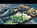 How to Create 3D Terrain with Google Maps and Blender!
![[Tutorial] Polystring Connections & Power Optimizers in PV*SOL premium (SolarEdge, Tigo, Maxim.. )](https://i.ytimg.com/vi/I8wMA7p7dbk/default.jpg) [Tutorial] Polystring Connections & Power Optimizers in PV*SOL premium (SolarEdge, Tigo, Maxim.. )
[Tutorial] Polystring Connections & Power Optimizers in PV*SOL premium (SolarEdge, Tigo, Maxim.. ) HelioScope Webinar Training
 Extract Google Earth/Google Maps 3D Buildings Part 2 - Ground Control Points (GCP)
 Google Maps to STL
 How to design PV Systems using PVSOL - Part 1
 Introducción al diseño de sistemas FV mediante PV*SOL premium 2020
 Using SketchUp to scale and then calculate area and volume for landscape construction estimates
 Software Tutorial - PV*SOL premium - Map Import and Extrusion Of 3D Objects for fast PV Systems
 Da Google Maps 3D a Sketchup...#Roma...
 How to design PV Systems using PVSOL - Part 2
 Extract Google Earth/Google Maps 3D Buildings Part 3 - 3D Building Models
 Tutorial del programa PV*SOL premium – Importación de mapas y extrusión de objectos en 3D
 PV*SOL premium Tutorial – Kartenimport und Extrudieren von 3D-Objekten für Photovoltaikanlagen