First Alert Forecast: Severe weather threat later this week in the Quad Cities
Aside from some clouds in southern portions of the TV6 viewing area this morning, there will be plenty of sunshine with highs reaching the upper 40s to lower 50s this afternoon with a light north wind.
Tuesday will start off with a few clouds and temperatures in the 30s, but we recover nicely back to the upper 40s and lower 50s with sunshine throughout the day.
A cold front moves through Wednesday knocking temperatures back to the 40s, but a warm front moves back through Thursday and brings the potential for a few showers in the afternoon.
All attention is on a strong storm system set to move in Friday, bringing the potential for scattered showers and thunderstorms with some severe thunderstorms possible. Details on timing, location of the strongest storms and where the warmer temperatures will be remain in question. Stay tuned to TV6 for updates this week.
For more Local News from KWQC: https://www.kwqc.com/
For more YouTube Content: https://www.youtube.com/channel/UCdAVIb4dBhAHhUaxfM5gAbg
Видео First Alert Forecast: Severe weather threat later this week in the Quad Cities канала KWQC News
Показать
Комментарии отсутствуют
Информация о видео
Другие видео канала
 SEVERE WEATHER OUTBREAK POTENTIAL 3/31/23: What you need to know
 Sunshine, 70s and 80s ahead for the Quad Cities this week
 Large hail, tornadoes, damaging wind possible Saturday in the Quad Cities area
 Spring...is that you??? The Quad Cities Most Reliable Forecast - 3/26/23 - KWQC-TV6
 Paula Sands Live | Gilda's Club Nutrition Workshop
 Paula Sands Live | Summer Fashions Pt 3
 Bettendorf grad soars high into the sky
 5 p.m., weather and Cops N Kids Book Drive
 Are we finally done with the bone dry weather? TV6 Meteorologist Cyle Dickens has the latest.
 WIU-SHA hosts I-74 Suspension Bridge Demolition Presentation
 Fort Madison, Iowa, 40 year sentence for hidden camera
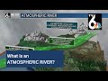 Science behind atmospheric rivers
 Continuing Coverage: Inspections Discrepancy
 Another severe weather outbreak possible Tuesday? Here is what you need to know
 American Muscle Cars 4 U hosts car show and fundraiser to help raise money for veterans
 Off and on rain today
 Paula Sands Live | Summer Fashions Pt 4
 Paula Sands Live | Mississippi Valley Fair 2017: The Tiger Encounter
 A dangerous day ahead - here's what you need to know
 The breakdown of the EF-0 tornado that hit Davenport, IA Saturday