Zambia/Lusaka/Africa ( People & Puplic markets) Part 2
Welcome to my travelchannel.On my channel you can find almost 1000 films of more than 70 countries. See the playlist on my youtube channel.Enjoy!
https://www.youtube.com/user/nurettinodunya/playlists
Zambia/Africa:
Zambia,officially the Republic of Zambia, is a landlocked country in Southern Africa. The neighbouring countries are the Democratic Republic of the Congo to the north, Tanzania to the north-east, Malawi to the east, Mozambique, Zimbabwe, Botswana and Namibia to the south, and Angola to the west. The capital city is Lusaka, located in the south-central part of the country. The population is concentrated mainly around Lusaka in the south and the Copperbelt Province to the northwest.
Originally inhabited by Khoisan peoples, the region which comprises modern Zambia was colonised during the Bantu expansion of the thirteenth century. After visits by European explorers in the eighteenth century, Zambia became the British colony of Northern Rhodesia towards the end of the nineteenth century. For most of the colonial period, the country was governed by an administration appointed from London with the advice of the British South Africa Company.
Zambia is a landlocked country in southern Africa, with a tropical climate and consists mostly of high plateau, with some hills and mountains, dissected by river valleys. At 752,614 km2 (290,586 sq mi) it is the 39th-largest country in the world (after Chile) and slightly larger than the US state of Texas. The country lies mostly between latitudes 8° and 18°S, and longitudes 22° and 34°E.
Zambia is drained by two major river basins: the Zambezi/Kafue basin in the centre, west and south covering about three-quarters of the country; and the Congo basin in the north covering about one-quarter of the country. A very small area in the northeast forms part of the internal drainage basin of Lake Rukwa in Tanzania.
In the Zambezi basin, there are a number of major rivers flowing wholly or partially through Zambia: the Kabompo, Lungwebungu, Kafue, Luangwa, and the Zambezi itself, which flows through the country in the west and then forms its southern border with Namibia, Botswana and Zimbabwe. Its source is in Zambia but it diverts into Angola, and a number of its tributaries rise in Angola's central highlands. The edge of the Cuando River floodplain (not its main channel) forms Zambia's southwestern border, and via the Chobe River that river contributes very little water to the Zambezi because most is lost by evaporation.
Two of the Zambezi's longest and largest tributaries, the Kafue and the Luangwa, flow mainly in Zambia. Their confluences with the Zambezi are on the border with Zimbabwe at Chirundu and Luangwa town respectively. Before its confluence, the Luangwa River forms part of Zambia's border with Mozambique. From Luangwa town, the Zambezi leaves Zambia and flows into Mozambique, and eventually into the Mozambique Channel.
The Zambezi falls about 100 metres (328 ft) over the 1.6 km (0.99 mi) wide Victoria Falls, located in the south-west corner of the country, subsequently flowing into Lake Kariba. The Zambezi valley, running along the southern border, is both deep and wide. From Lake Kariba going east it is formed by grabens and like the Luangwa, Mweru-Luapula, Mweru-wa-Ntipa and Lake Tanganyika valleys, is a rift valley.Eastern Zambia shows great diversity. The Luangwa Valley splits the plateau in a curve north east to south west, extended west into the heart of the plateau by the deep valley of the Lunsemfwa River. Hills and mountains are found by the side of some sections of the valley, notably in its north-east the Nyika Plateau (2,200 m/7,218 ft) on the Malawi border, which extend into Zambia as the Mafinga Hills, containing the country's highest point, Kongera (2,187 m/7,175 ft). The Muchinga Mountains, the watershed between the Zambezi and Congo drainage basins, run parallel to the deep valley of the Luangwa River and form a sharp backdrop to its northern edge, although they are almost everywhere below 1,700 m (5,577 ft). Their culminating peak Mumpu is at the western end and at 1,892 m (6,207 ft) is the highest point in Zambia away from the eastern border region. The border of the Congo Pedicle was drawn around this mountain.
The southernmost headstream of the Congo River rises in Zambia and flows west through its northern area firstly as the Chambeshi and then, after the Bangweulu Swamps as the Luapula, which forms part of the border with the Democratic Republic of the Congo. The Luapula flows south then west before it turns north until it enters Lake Mweru. The lake's other major tributary is the Kalungwishi River, which flows into it from the east. The Luvua River drains Lake Mweru, flowing out of the northern end to the Lualaba River (Upper Congo River).Wikipedia
Видео Zambia/Lusaka/Africa ( People & Puplic markets) Part 2 канала Nurettin Yilmaz
Показать
Комментарии отсутствуют
Информация о видео
Другие видео канала
 First Time In Africa: Ep 2 - Backpacking in Botswana & Zambia
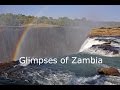 Glimpses of Zambia, 2015
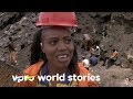 Copper mines in Zambia - Straight through Africa | VPRO Documentary
 Design and Construction of Lusaka City Decongestion Project 01 2sep 2016 01 Final
 Travel to Zambia in Urdu/Hindi | Zambia Information History | Story of Zambia | Documentary
 Lusaka to Johannesburg ¦¦ Bus Travel
 Africa Market in Stonetown, Zanzibar TZ
 ज़ाम्बिया अद्धभुत देश // Zambia amazing country || Amazing facts about Zambia in Hindi
 Zambian Food
 Faces Of Africa - When Chinese Meet Zambians
 Lusaka Markets - The Best of Zambia
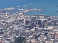 Cape Town South Africa HD
 Lusaka: 100 Years
 Welcome to Zambia, The Real Africa
 Boeing 747-400F Rainy Landing in Lusaka, Zambia - Cockpit View w/ ATC
 A Day in the Life of Lusaka, Zambia
 ZAMBIA: Real African fruit 🥭 and fish market 🐟 in Livingstone, let's go!
 Travel To Zambia | Zambia History And Documentary In Urdu And Hindi | Jani TV | زیمبيا کی سیر
 Expedition vehicle on the streets of Zambia • Expedition truck • World tour
 Kabwe → Lusaka - Zambia