Tropical Storm BONNIE - Miami Beach, Florida - July 23, 2010
On July 23rd, 2010 Tropical Storm Bonnie became the second named, and second landfalling, storm of the 2010 Atlantic hurricane season.
Between July 20th and 21st an area of disturbed weather associated with a tropical wave, interacting with a large upper-level low, moved west-northwest over the northeastern Caribbean and southeast Bahamas producing very heavy rainfall and extensive flooding over Puerto Rico and the Dominican Republic. On July 22nd, the strong shear, that had been preventing development, relaxed as the upper-low moved far enough west of the disturbance. By morning, visible satellite imagery indicated that a low-level center had formed over the central Bahamas and by 11am, the system was classified Tropical Depression Three, while moving west-northwest towards Southeast Florida.
By early evening on the 22nd, the depression reached Tropical Storm strength and was named Bonnie. In response to strong southeasterly winds on the east side of the upper-low, Bonnie moved more towards the northwest before bending back towards the west-northwest on the morning of the 23rd. These strong upper-level winds also prevented strengthening and Bonnie struggled to maintain deep convection near the center while remaining a weak tropical storm as it rapidly approached southeast Florida.
Between 9am and 11am on July 23rd, the center of Tropical Storm Bonnie moved rapidly west-northwest at 18 mph (16 kts) across Biscayne Bay, making landfall near Cutler Bay, Florida (just south of Miami) as a minimal tropical storm with maximum sustained winds of 40 mph (35 kts) and a minimum central pressure of 1008 mb (29.77 in). One large primary rainband to the northwest and west of the storm's center brought some brief heavy squalls to the coastal areas of Miami-Dade county as Bonnie neared landfall.
On the morning of July 23rd, storm chaser Michael Laca intercepted Tropical Storm Bonnie at Miami Beach, Florida. At my location I encountered a brief period of sustained winds near 35-40 mph (30-35 kts) with peak gusts near 45 mph (40 kts) and heavy rain.
Tropical Storm Bonnie had a very small wind field and produced a brief period of minimal tropical storm condtions across portions of Miami-Dade county. The highest officially reported winds in southeast Florida during Bonnie's passage were 47 mph (41 kts) with a peak gust of 58 mph (50 kts) at RSMAS on Virginia Key (just south of Miami); 31 mph (27 kts) with a peak gust of 39 mph (34 kts) at Tamiami airport and 26 mph (23 kts) with a peak gust of 36 mph (31 kts) and a minimum pressure of 1009.4 mb (29.81 in) at Homestead General Airport in extreme southern Miami-Dade county. Unofficial wind readings include 41 mph (36 kts) with a peak gust of 47 mph (41 kts) from a private anemometer in the community of Palmetto Bay, along with a minimum pressure of 1007 mb (29.74 in).
During the late morning and afternoon, Tropical Storm Bonnie exited the southeast metro areas and crossed the southern Florida peninsula, emerging into the Gulf of Mexico as a tropical depression by early evening.
Due to the continued proximity of the large upper-level low to the west of Bonnie, strong southeasterly shear prevented the depression from restrengthening and Bonnie degenerated into a low-level remnant swirl over the northern Gulf of Mexico on July 24th. The remnant low eventually crossed directly over the BP oil spill area and made landfall over southeastern Louisiana with little effects.
Видео Tropical Storm BONNIE - Miami Beach, Florida - July 23, 2010 канала Tropmet | Storm Chasing
Показать
Комментарии отсутствуют
Информация о видео
Другие видео канала
 Vintage 8mm Home Movies - Miami, Florida - Circa 1957
 Tropical Storm BOB (National Hurricane Center) July 23, 1985
 After The Chase - Tulia, TX - May 6, 2008
 Funnel Clouds - Key West, Florida - July 23, 1988
 Hurricane RITA - Key West, Florida (KBYX) Radar Loop - September 20, 2005
 Time Lapse Test - Miami, Florida - August 12, 2007
 Tornadic Supercell - Wilson County, KS - May 1, 2008
 Sony HDR-FX1000 - Low Light Test #1
 Sony HDR-FX1000 - Low Light Test #3
 Jack Crevalle - Riviera Beach, Florida
 Vintage 8mm Home Movies - Macy's Thanksgiving Day Parade - New York - November 25, 1954
 Lightning / Squall Line - Bartlesville, OK - May 2, 2008
 Hurricane RITA - Visible/Infra-Red Satellite Loop
 Hurricane KATRINA - Visible/Infra-Red Satellite Loop
 Valentine's Weekend Squall Line - Miami, Florida - February 12, 2010
 Tornadic Supercell - South Hutchinson, KS - May 23, 2008
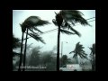 Hurricane RITA (High Quality) - Key West, Florida - September 20, 2005
 Hurricane IAN - Port Charlotte, Florida - 4K EXTENDED EDITION (1 HOUR)
 Hurricane WILMA - Key West, Florida (KBYX) Radar Loop - October 24, 2005
 Hurricane KATRINA - Miami Florida (KAMX) Radar Loop - August 25, 2005