Lesson 8 - U.S. Geological Survey Topographic Maps
In this lesson we will examine a brief history of the USGS topographic map, Introduce US Topo maps and their content, discuss the production and future goals of US Topo, and learn how to access these maps for viewing or printing.
Видео Lesson 8 - U.S. Geological Survey Topographic Maps канала USGS
Видео Lesson 8 - U.S. Geological Survey Topographic Maps канала USGS
Показать
Комментарии отсутствуют
Информация о видео
Другие видео канала
 Lesson 1 - Introduction to Using The National Map Products and Services
 Lesson 6a - Using USGS US Topo and Historic Topographic Maps on your Mobile Device
 US Topo
 March 2, 2022 — Kīlauea summit overflight
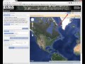 Lesson 7a - EarthExplorer Introduction
 Monthly update of activity at Yellowstone Volcano for March 2022
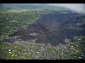 Kīlauea lower East Rift Zone 2019: quiet but insightful
 Lesson 7c - EarthExplorer Results
 Yellowstone Volcano Observatory Monthly Update for October 2020
 Sea to summit: An overview of landslides in Maine
 Nitrogen in the Chesapeake Bay Watershed—A Century of Change
 February 7– 10, 2022 – Kīlauea summit eruption thermal timelapse video
 February 17, 2022 — Typical activity at the west vent in Halema‘uma‘u, Kīlauea
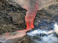 Lava lake in Halema‘uma‘u remains active
 PRMS Overview
 North Pacific Marine Heatwave
 What’s happening at Kīlauea Volcano’s summit?
 The story of Yellowstone's ups and downs