MineScope - CGG Satellite Mapping
CGG’s MineScope service provides remote, satellite-derived intelligence to help mining companies, specialists and consultants make smarter geological, geotechnical and safety-related decisions throughout the mining lifecycle. It consists of a comprehensive suite of data solutions that improve exploration efficiency and situational awareness by helping to reduce risk during the planning, auditing and monitoring of mine operations and tailings storage facilities.
Видео MineScope - CGG Satellite Mapping канала CGGcompany
Видео MineScope - CGG Satellite Mapping канала CGGcompany
Показать
Комментарии отсутствуют
Информация о видео
Другие видео канала
 OSINT At Home #9 – My Top 4 Free Satellite Imagery Sources
 Space Mining Is Here, Led by This Tiny Country
 Airborne Electromagnetic data - mapping mineral and groundwater resources
 This is CGG
 508XT : seismic survey in Saudi Arabia - Sercel
 Join the online seminar: Mineral Exploration via Satellite Remote Sensing
 Discover CGG
 Spy Satellite Expert Explains How to Analyze Satellite Imagery | WIRED
 $1,000,000 Gold Deposit Found Over The Weekend
 How to get the most current satellite imagery
 Seismic Imaging
 TopSeis - a unique solution for acquiring near offsets (full video)
 Goldfields _ Tarkwa Mine
 Satellite Applications and Intelligent Transport
 Satellites Use 'This Weird Trick' To See More Than They Should - Synthetic Aperture Radar Explained.
 Geological Misfits: 4 Small Weird Places
 6 Mysteries Geologists Can’t Explain — Yet!
 USDA-ARS Monitoring Water Quality Using Drones
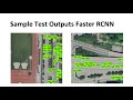 Vehicle Detection from Satellite Images using Deep Learning
 Gravity Visualized