SMCT: Determine Grid Azimuths Using a Protractor
A visualization depicting the Soldier’s Manual of Common Tasks (STP 21-1-SMCT) task Determine Grid Azimuths Using a Protractor (071-COM-0018). This was developed for the Center for Initial Military Training, FT Eustis, Va. This visualization has been approved for public release.
Storyboard developed from the STP 21-1 Soldier's Manual of Common Tasks Warrior Skills Level 1, September 2017
Approved by the Center for Initial Military Training (CIMT) G-3/5/7, Initial Entry Training, Fort Eustis Virginia.
Видео SMCT: Determine Grid Azimuths Using a Protractor канала OEC G&V
Storyboard developed from the STP 21-1 Soldier's Manual of Common Tasks Warrior Skills Level 1, September 2017
Approved by the Center for Initial Military Training (CIMT) G-3/5/7, Initial Entry Training, Fort Eustis Virginia.
Видео SMCT: Determine Grid Azimuths Using a Protractor канала OEC G&V
Показать
Комментарии отсутствуют
Информация о видео
Другие видео канала
 SMCT: Convert Azimuths and Compute Back Azimuths
 SMCT: Determine the Grid Coordinates of a Point on a Military Map
 CIT : Determine a Grid Azimuth Using a Military Protractor
 Magnetic Declination Demystified
 How to Identify Key Terrain Features For Whitetails on a Topographical Map
 SMCT: Identify Topographic Symbols on a Military Map
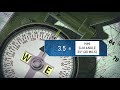 SMCT: Orient a Map Using a Lensatic Compass
 SMCT: Navigate from One Point on the Ground to Another While Dismounted
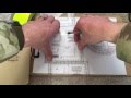 Day and night land navigation tips and tricks
 SMCT: Determine a Location on the Ground by Terrain Association
 Mendoza_CIT convert azimuth
 SMCT: Locate an Unknown Point on the Ground by Intersection
 SMCT: Measure Distance on a Map
 Compass Basics PT2: How to Shoot a Back Azimuth (Back Bearing)🔅
 Plotting UTM Coordinates with a Grid Tool
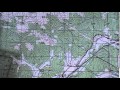 Determine azimuth
 Identifying Terrain Features on a Map
 How to determine a grid azimuth using a protractor.
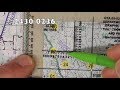 How to Plot 8 Digit Grid Coordinates