Earthquake hazard display analysis in arcgis
Myanmar Language Version
For the Improving Myanmar GIS Academics .
GeoCAD (Geological Computer Training Center)
GeoCAD , GIS and RS , Surveying and Aerial Mapping Module are can be learning in GeoCAD Training Center.
Contact us ! +95932261838, +959 795281542
geocad2015@gmail.com
Видео Earthquake hazard display analysis in arcgis канала Zin Wai Naing Tun GeoCAD Myanmar
Показать
Комментарии отсутствуют
Информация о видео
16 января 2018 г. 9:11:20
00:05:06
Другие видео канала
 How to create Seismic hazard map in ArcGIS using R-CRISIS Data
 How to Make this Crazy Map of Hurricanes since 1851
 Free Download Earthquakes Data-set for Myanmar
 The Future of Earthquake-Proof Buildings
 How to download earthquake data from USGS & arrange it in Excel
 Basic Geophysics: Earthquake Hazard
 CROPLAND SUITABILITY ZONE (AHP) METHOD IN WEIGHTED OVERLAY BY ARC GIS 10.3
 Create Multidimensional Rasters from a Collection of Images
 Flood Analysis with Arc GIS
 MATLAB for Analyzing and Visualizing Geospatial Data
 ArcGIS Tip & Tricks Part -1
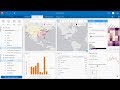 ArcGIS Insights: Introduction to Data Analysis Techniques
 How To Download Soil Map For Any Study Area And Classify The Soil Type
 Weighted Overlay in GIS
 Calculating Statistically Significant Hotspots Using the Hotspot Analysis Plugin in QGIS
 QGIS Earth Quake Analysis | Civil Engineering Stuff
 How to Install ArcGIS 10.6 Crack Software: English Audio
 interpolation Analysis Using ArcGIS
 Lesson 19 Seismic Interpretation
 Lecture : 3 | ArcGIS 10 : Georeferenceing