- Популярные видео
- Авто
- Видео-блоги
- ДТП, аварии
- Для маленьких
- Еда, напитки
- Животные
- Закон и право
- Знаменитости
- Игры
- Искусство
- Комедии
- Красота, мода
- Кулинария, рецепты
- Люди
- Мото
- Музыка
- Мультфильмы
- Наука, технологии
- Новости
- Образование
- Политика
- Праздники
- Приколы
- Природа
- Происшествия
- Путешествия
- Развлечения
- Ржач
- Семья
- Сериалы
- Спорт
- Стиль жизни
- ТВ передачи
- Танцы
- Технологии
- Товары
- Ужасы
- Фильмы
- Шоу-бизнес
- Юмор
Earth’s Hidden Eighth Continent Confirmed
Scientists have mapped the full extent of Zealandia, widely regarded by geologists as Earth’s eighth continent — a vast, mostly submerged landmass beneath the South Pacific Ocean.
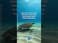
Covering about 5 million square kilometers, Zealandia is roughly the size of greater India. Around 94% of it lies below sea level, with New Zealand, New Caledonia, and nearby islands forming its visible parts.
For decades, geologists debated whether this region was a true continent or a collection of scattered fragments. Research has shown that Zealandia has the key features of continental crust: large area, elevated seafloor, varied geology, and a clear boundary from surrounding oceanic crust.
Zealandia separated from Gondwana around 80 million years ago. As its crust stretched and thinned, much of the landmass gradually sank beneath the ocean while remaining a coherent continental block.
Researchers completed its geological mapping using seabed rock samples, including sandstones, granite and volcanic pebbles, and basalts dated from the Early Cretaceous to the Eocene, together with magnetic anomaly data from the crust.
Because most of Zealandia has stayed underwater for millions of years, it offers a rare window into continental rifting, thinning, and breakup — processes that are harder to study on land.
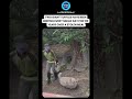
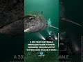
Images are generated by AI and for demonstration purposes only.
Source: Mortimer, N., et al. (2023). Reconnaissance basement geology and tectonics of North Zealandia. Tectonics, 42, e2023TC007961.
#science #geology #earthscience #zealandia #continent #ocean #nature #discovery #fblifestyle
Видео Earth’s Hidden Eighth Continent Confirmed канала Our Blue Planet
Covering about 5 million square kilometers, Zealandia is roughly the size of greater India. Around 94% of it lies below sea level, with New Zealand, New Caledonia, and nearby islands forming its visible parts.
For decades, geologists debated whether this region was a true continent or a collection of scattered fragments. Research has shown that Zealandia has the key features of continental crust: large area, elevated seafloor, varied geology, and a clear boundary from surrounding oceanic crust.
Zealandia separated from Gondwana around 80 million years ago. As its crust stretched and thinned, much of the landmass gradually sank beneath the ocean while remaining a coherent continental block.
Researchers completed its geological mapping using seabed rock samples, including sandstones, granite and volcanic pebbles, and basalts dated from the Early Cretaceous to the Eocene, together with magnetic anomaly data from the crust.
Because most of Zealandia has stayed underwater for millions of years, it offers a rare window into continental rifting, thinning, and breakup — processes that are harder to study on land.
Images are generated by AI and for demonstration purposes only.
Source: Mortimer, N., et al. (2023). Reconnaissance basement geology and tectonics of North Zealandia. Tectonics, 42, e2023TC007961.
#science #geology #earthscience #zealandia #continent #ocean #nature #discovery #fblifestyle
Видео Earth’s Hidden Eighth Continent Confirmed канала Our Blue Planet
Комментарии отсутствуют
Информация о видео
20 ч. 16 мин. назад
00:00:25
Другие видео канала