GIS 3D Analyst / ArcScene tutorial with John Snow's 1854 Cholera Data
This ArcGIS tutorial walks through how to create a 3D surface using ArcScene, 3D Analyst and Spatial Analyst. The example given is using John Snow's famous cholera investigation in SoHo, London. There are multiple sources for the similar data used in this presentation - including data compiled by Robin Wilson which can be found here: http://www.rtwilson.com/downloads/SnowGIS_v2.zip
Видео GIS 3D Analyst / ArcScene tutorial with John Snow's 1854 Cholera Data канала Chris Goranson
Видео GIS 3D Analyst / ArcScene tutorial with John Snow's 1854 Cholera Data канала Chris Goranson
Показать
Комментарии отсутствуют
Информация о видео
Другие видео канала
 Using ArcScene with ArcGIS 10.2
 ArcGis - ArcScene 3D
 how to visualize aquifer surfaces using ArcGis/ArcScene
 Creating Smart 3D City Models with Esri CityEngine
 GIS Spatial Analyst Tutorial using John Snow's Cholera Data
 Arcgis 3d Analyst Visualizing soil contamination and Edema Rate
 Geocoding in ArcGIS 10.x
 How to: creating 3D lines of sight in ArcScene
 analysis of a digital elevation model in ArcMAP
 Analyzing Data in 3D in ArcGIS Desktop
 ArcScene Basics
 Lecture 2: GIS vector data
 Using ArcMap 10 to join Excel data with a shapefile
 ArcMap 10.1 LIDAR features compared to LP360
 Network Analyst - Creating Service Areas
 Dropping your shapefile and your maps on 3D by ArcScene 10.x
 ArcGIS - ArcScene - 3D
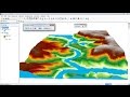 ArcGis 3d Analyst/ ArcScene Animation of flood
 Impacting the Future - How 3D GIS Informs Smart Planning
 Performing Proper Density Analysis Part 1