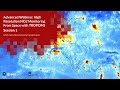
NASA ARSET: Python Tools for Analyzing NO2, Part 3/3
This webinar will primarily consist of going through an exercise on using updated python codes to work with TROPOMI data. This will include reading, mapping, extracting over a point location, gridding the data, and dumping the data to a CSV file.
Download materials from this presentation: https://arset.gsfc.nasa.gov/airquality/webinars/advanced-NO2-2019
This training was created by NASA's Applied Remote Sensing Training Program (ARSET). ARSET is a part of NASA's Applied Science's Capacity Building Program. Learn more about ARSET: http://arset.gsfc.nasa.gov/
Видео NASA ARSET: Python Tools for Analyzing NO2, Part 3/3 канала NASA Video
Показать
Комментарии отсутствуют
Информация о видео
Другие видео канала
 NASA ARSET: Remote Sensing of NO2 with OMI, Part 1/3
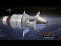 NASA | Exploration Mission-1 – Pushing Farther Into Deep Space
 Creating Beautiful and Meaningful Visualizations with Big Data
 15 Python Projects in Under 15 Minutes (Code Included)
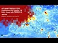 NASA ARSET: Introducing TROPOMI - High Resolution NO2 Observations from Space, Part 2/3
 11 Open NASA Data From API to Data Analysis
 Air Quality Prediction Using Linear Regression Algorithm
 RUS Webinar: Air quality monitoring with Sentinel-5P - ATMO01
 NASA ARSET: Mapping and Monitoring Lakes and Reservoirs with Satellite Observations, Part 1/3
 Creating Interactive Maps with Python
 NASA ARSET: Land Cover Classification with Radar and Optical Data, Part 2/4
 What is Python? | Python Programming For Beginners | Python Tutorial | Edureka
 Estimating Ground-Level PM₂.₅ in China Using Aerosol Optical Depth Determined from...
 Python Scripting for Exporting Multiple Rasters into Time Series
 NASA ARSET: Introduction to Time Series Analysis & AppEEARS , Session 1/2
 NASA ARSET: Satellites, Sensors, and Earth Systems Models for Water Resources Management
 RUS Webinar: Processing Copernicus data in Python using snappy - PY01
![Learn Python - Full Course for Beginners [Tutorial]](https://i.ytimg.com/vi/rfscVS0vtbw/default.jpg) Learn Python - Full Course for Beginners [Tutorial]
Learn Python - Full Course for Beginners [Tutorial] COVID-19 Impacts - Nitrogen Dioxide Emissions Massively Drop over China!