- Популярные видео
- Авто
- Видео-блоги
- ДТП, аварии
- Для маленьких
- Еда, напитки
- Животные
- Закон и право
- Знаменитости
- Игры
- Искусство
- Комедии
- Красота, мода
- Кулинария, рецепты
- Люди
- Мото
- Музыка
- Мультфильмы
- Наука, технологии
- Новости
- Образование
- Политика
- Праздники
- Приколы
- Природа
- Происшествия
- Путешествия
- Развлечения
- Ржач
- Семья
- Сериалы
- Спорт
- Стиль жизни
- ТВ передачи
- Танцы
- Технологии
- Товары
- Ужасы
- Фильмы
- Шоу-бизнес
- Юмор
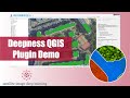
Chat2Geo Demo
Shahab Jozdani gives a tour of Chat2Geo, a web app that lets you turn plain-language prompts into geospatial workflows: draw an area of interest, request a fresh land-cover map, pull OpenStreetMap layers, tweak styling, and more.
PROJECT REPO
• https://github.com/GeoRetina/chat2geo
🚀 TIMELINE
00:00 Intro & welcome
00:11 First look at the Chat2Geo interface
00:40 Drawing a region of interest (ROI)
01:26 Requesting a summer-2024 land-cover map
02:57 Extracting building footprints from OSM
03:51 Adding road vectors to the map
04:32 Styling layers – opacity, colours, visibility
05:15 Feedback button & support flow
05:49 Sidebar tour – chat history, knowledge base, integrations, usage stats
06:44 Open-source edition overview
06:55 Tech stack today (TypeScript) and upcoming Python analytics engine
08:14 Debugging: client-side vs server-side tools
09:30 Website walk-through and contact options
10:46 Wrap-up and roadmap hints
KEY TAKE-AWAYS
• Natural-language prompts drive full geospatial analyses – no code needed.
• Built-in OSM querying fetches buildings, roads and more with a single sentence.
• Users can upload docs to a RAG knowledge base and blend them with map queries.
• The open-source core is already feature-rich; a commercial tier adds integrations and usage limits.
• Future releases will add a Python backend for heavier remote-sensing workloads.
Enjoy the episode? Like, Subscribe, and share your questions below!
Видео Chat2Geo Demo канала Robin Cole
Комментарии отсутствуют
Информация о видео
2 июля 2025 г. 15:26:17
00:10:58
Другие видео канала