How LiDAR is transforming our understanding of the Roman Road network in NW Eng by David Ratledge
Until recently, the network of Roman roads serving the dense concentration of Roman forts in North-Western England was only poorly understood, with long stretches where routes were lost. Traditional research methods, such as field walking and aerial-photography, had just about been exhausted. Fortunately, imagery derived from LiDAR data can often reveal the surviving remains of the agger, terraces, side ditches and cuttings, where they cannot be easily identified through traditional fieldwork. Using LiDAR, many missing pieces have now been found, along with previously unknown roads and some major surprises. In one instance, the destination of a supposedly well-known major road was shown to be incorrect and in another, a fort believed to be at the end of a cul-de-sac was found to be on two previously unknown routes into Scotland. Clearly, without an understanding of the Roman road network establishing the roles of forts can be fraught with errors.
This talk was recorded live via Zoom as part of our online seminar series
Видео How LiDAR is transforming our understanding of the Roman Road network in NW Eng by David Ratledge канала Roman Roads Research Association
This talk was recorded live via Zoom as part of our online seminar series
Видео How LiDAR is transforming our understanding of the Roman Road network in NW Eng by David Ratledge канала Roman Roads Research Association
Показать
Комментарии отсутствуют
Информация о видео
27 июня 2021 г. 20:19:46
01:28:47
Другие видео канала
 How to identify a Roman Road by Mike Haken
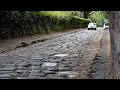 Were Roman Roads more Durable than Modern Highways?
 Travelling with Romans - Lancashire's Roman Roads
 Walking along a forgotten Roman Road
 Roman Camps in Scotland
 Were all Roman Roads Straight? - Map Mysteries.
 Why did this Roman Road Bend so much? Map Mysteries
 The Roman Road. That had a Significant Kink
 Edgworth Roman Road - the Missing Link
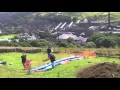 Roman Road across the Pennines
 Walking roman roads
 Norway’s $47BN Coastal Highway
 Did This Roman Road Actually Bend? A Roman Road Discovery
 How England's Oldest Road Was Nearly Lost Forever
 The Difference between the UK, Great Britain & England Explained
 The road over High Street in the English Lake District - is it Roman? by John Poulter
 The Stainmore road, its unique Roman camps, and Venutius's war by Mike Haken
 A Forgotten Roman Road In Cheshunt | FULL EPISODE | Time Team
 English version. How were Roman roads made?
 Modeling Biomass and Canopy Fuel Attributes Using LIDAR Technology