⁴ᴷ⁶⁰ Driving Buckley Highway (Connecticut Routes 190 and 171) in Union, Connecticut
January 14, 2023 - 12:50 PM
34°F / 1°C
Dashcam view of driving eastbound on Buckley Highway (Connecticut Route 190 and Connecticut Route 171) through Union, Connecticut, from Fish Point Road to Mashapaug Road.
Highlights:
Interstate 84 interchange - 1:27
Old Town Hall (on right) - 5:29
Congregational Church of Union (on left) - 5:40
Union Public Library (on right) - 5:56
Connecticut Route 190 ends; Connecticut Route 171 portion begins - 6:48
Union Town Hall (on right) - 7:14
From Wikipedia:
Union is a town located in the northeastern part of Tolland County, Connecticut, United States and is part of the Quinebaug and Shetucket Rivers Valley National Heritage Corridor. The population was 785 at the 2020 census, making it the least populous town and municipality in Connecticut. Union includes the village of Mashapaug located in the Eastern Uplands at the Massachusetts state line. Union is located 33 miles (53 kilometers) northeast of the state capital, Hartford and 67 mi (108 km) southwest of Boston as well as 153 mi (246 km) northeast of New York City.
There were 500 people in the town in 1756. The population grew to 767 by 1800, but declined thereafter. There were just 431 people in Union in 1890. The official population of the town is still less than 1,000 residents today.
Union has the highest town center in eastern Connecticut at 1,015 feet (309 m) and the 4th highest in the state. The highest elevation in eastern Connecticut is 1,315 feet (401 m) Burley Hill in the northwest part of town. In addition, I-84 reaches its highest elevation in Connecticut (1,002 feet (305 m)) in Union.
Approximately one-third of the town is state park land, including Bigelow Hollow State Park, Nipmuck State Forest and the Mountain Laurel Sanctuary. A portion of the Yale-Myers Forest and Hull Foresters are located in Union. All combined, there are nearly 34,000 acres of forestland in Union.
Видео ⁴ᴷ⁶⁰ Driving Buckley Highway (Connecticut Routes 190 and 171) in Union, Connecticut канала Walking & Driving Incognito
Показать
Комментарии отсутствуют
Информация о видео
Другие видео канала
 ⁴ᴷ⁶⁰ Walking Old Fort Niagara in Youngstown, New York
 ⁴ᴷ⁶⁰ Walking Mexico City: Sordo Madaleno architecture exhibition at Palacio de Iturbide
 ⁴ᴷ⁶⁰ Walking Cattus Island County Park in Toms River, New Jersey
 ⁴ᴷ⁶⁰ Walking Montréal, Québec: Mary, Queen of the World Cathedral
 ⁴ᴷ⁶⁰ Driving NYC: Robert F. Kennedy Triboro Bridge from The Bronx to Queens
 ⁴ᴷ⁶⁰ Walking Newport, RI: Bowen's Wharf and Bannister's Wharf
 ⁴ᴷ⁶⁰ Walking tour of Westwood, New Jersey
 ⁴ᴷ⁶⁰ Walking Millbrook Village at Delaware Water Gap National Recreation Area, New Jersey
 ⁴ᴷ⁶⁰ Driving Seven Bridge Road (US Route 209) in Smithfield Township, Pennsylvania
 ⁴ᴷ⁶⁰ Driving NYC: College Point Boulevard in Flushing, Queens
 ⁴ᴷ⁶⁰ Walking tour of downtown Fort Lee, New Jersey
 ⁴ᴷ⁶⁰ Walking Mexico City: Avenida Francisco Madero from Eje Central to Zócalo
 ⁴ᴷ⁶⁰ Walking Stony Point Battlefield National Historic Landmark in Stony Point, New York
 ⁴ᴷ⁶⁰ Night driving music video: W O L F C L U B - Summer Lights
 ⁴ᴷ⁶⁰ Walking Babson College in Wellesley, Massachusetts
 ⁴ᴷ⁶⁰ Walking Boston, MA: The campus of Boston University
 ⁴ᴷ⁶⁰ Walking West Point Foundry Preserve in Cold Spring, New York
 ⁴ᴷ⁶⁰ Walking Manhattan Project National Historical Park in Los Alamos, New Mexico
 ⁴ᴷ⁶⁰ Night driving music video: STRFKR - Golden Light
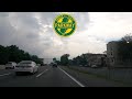 ⁴ᴷ⁶⁰ Driving Garden State Parkway from Union, NJ to East Orange, NJ